SAR Imagery Reveals the Presence of Concealed Submarine at North Korea’s Sinpo Naval Base
This article demonstrates the use of commercially available Synthetic Aperture Radar (SAR) imagery from satellites as a tool to augment electro-optical (EO) multispectral and panchromatic satellite imagery typically used for analysis. While concealed to visible imaging satellites, recent SAR imagery revealed the presence of the North Korean SINPO-class experimental ballistic missile submarine (SSBA) and its submersible test stand barge positioned beneath a recently constructed, dockside awning designed to conceal and environmentally protect these vessels.
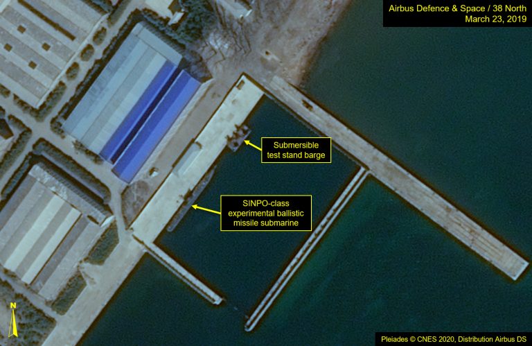
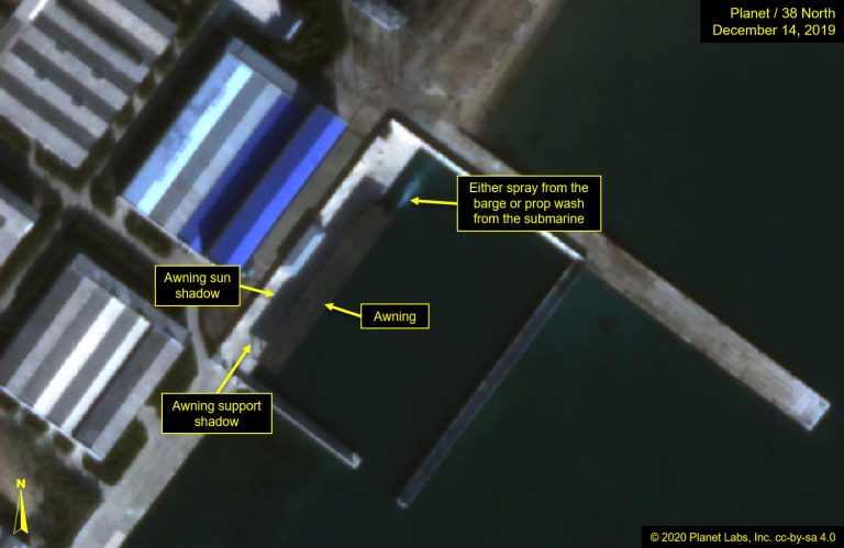
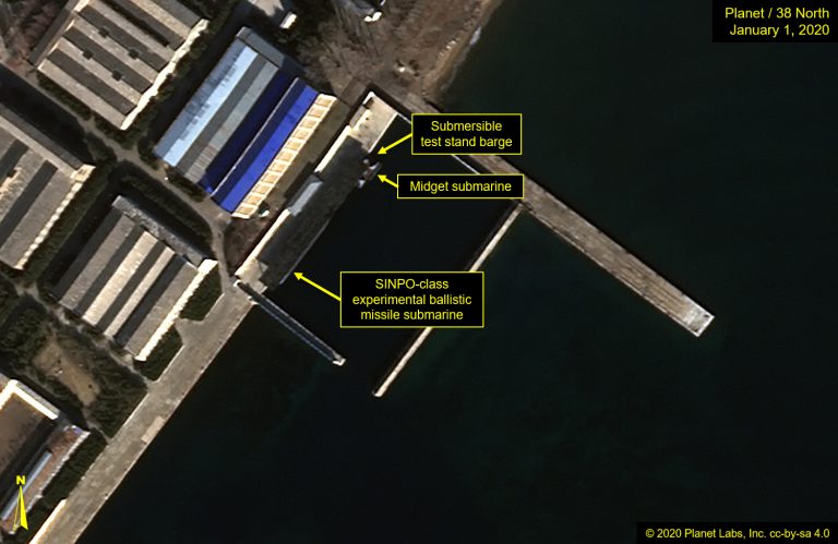
The secure boat basin at the North Korean Sinpo South Shipyard is where the experimental submarine and its submersible launch barge are usually docked. When present, these vessels had been readily visible to imaging satellites until a linear awning was erected along the quay, covering their normal berthing positions, thus frequently obscuring their presence or absence. Figure 1 shows the varying effectiveness of that awning. Sized to accommodate both the submarine and the launch barge, the awning can block the vessels from the prying eyes of the usual imaging satellites. December 14, 2019 is an exemplar, however, the direction and angle of the image taken January 1, 2020 renders the submarine, launch barge and midget submarine discernible. EO satellites collect imagery close to nadir, but their viewing perspective will vary depending on direction and angle, while SAR satellites image from the side.
Figure 1. Overview of secure boat basin; images compare EO satellite images before and after awning placement. The SINPO-class submarine, submersible barge and midget submarine are visible at the secure boat basin on January 1, 2020.
In addition to SAR imagery’s ability to collect day or night and penetrate heavy haze or cloud cover, it also has the ability to look under shelters, such as the awning installed at Sinpo. SAR satellites work most effectively by pointing their radar sensors at low incidence angles in the 15 to 30-degree range above the horizon. In this case, the TerraSAR-X satellite, operating at 23.5 degrees above the horizon, was able to “peek” from the side below the awning to image the submarine. (Figure 2) The submarine on December 16, 2019, is there along with its barge in the SAR image, but not detectable by the visible image of December 14, 2019.
Figure 2. SAR image of the secure boat basin.
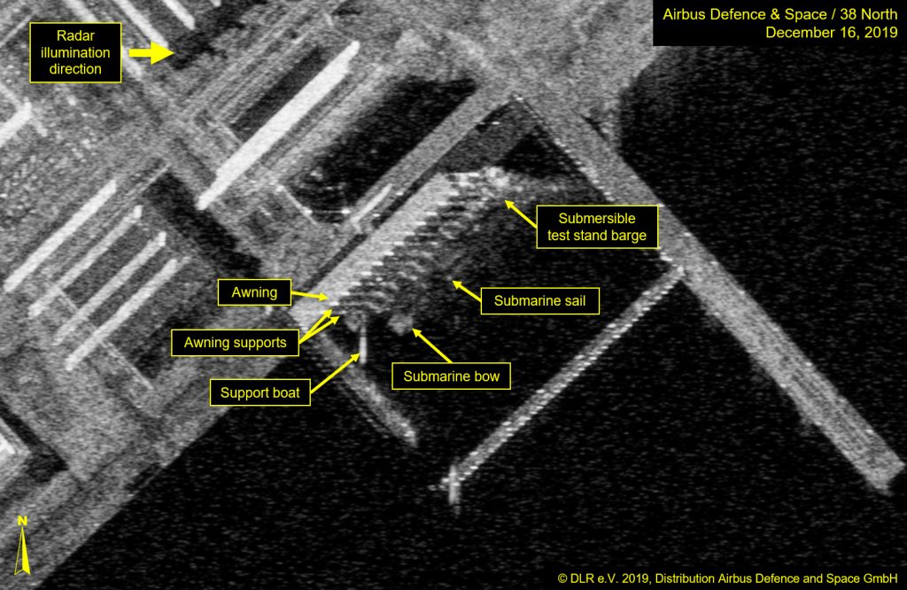
For viewers unfamiliar with SAR, images appear quite bizarre, principally because of the layover and foreshortening phenomena that tilt objects toward the satellite radar source. Figure 3 illustrates the cause of layover and foreshortening. A SAR image is constructed by mapping the radar range returns against the angle of the returns. As Figure 3 shows, the roof of a building is typically closer to the satellite than the building foundation, so the roof gets projected as being closer to the satellite. This applies to tall objects as well, making them “tilt” toward the radar source. Also significant is foreshortening where upward sloping features relative to the satellite are compressed relative to the satellite. Figures 2 and 4 illustrate some examples of the visual effects; note the tilt of the awning toward the satellite radar source and even that of the submarine sail.
Figure 3. Diagram of how visual distortions are caused in SAR imagery.
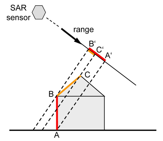
Figure 4. Layover and foreshortening examples in SAR imagery of Sinpo.
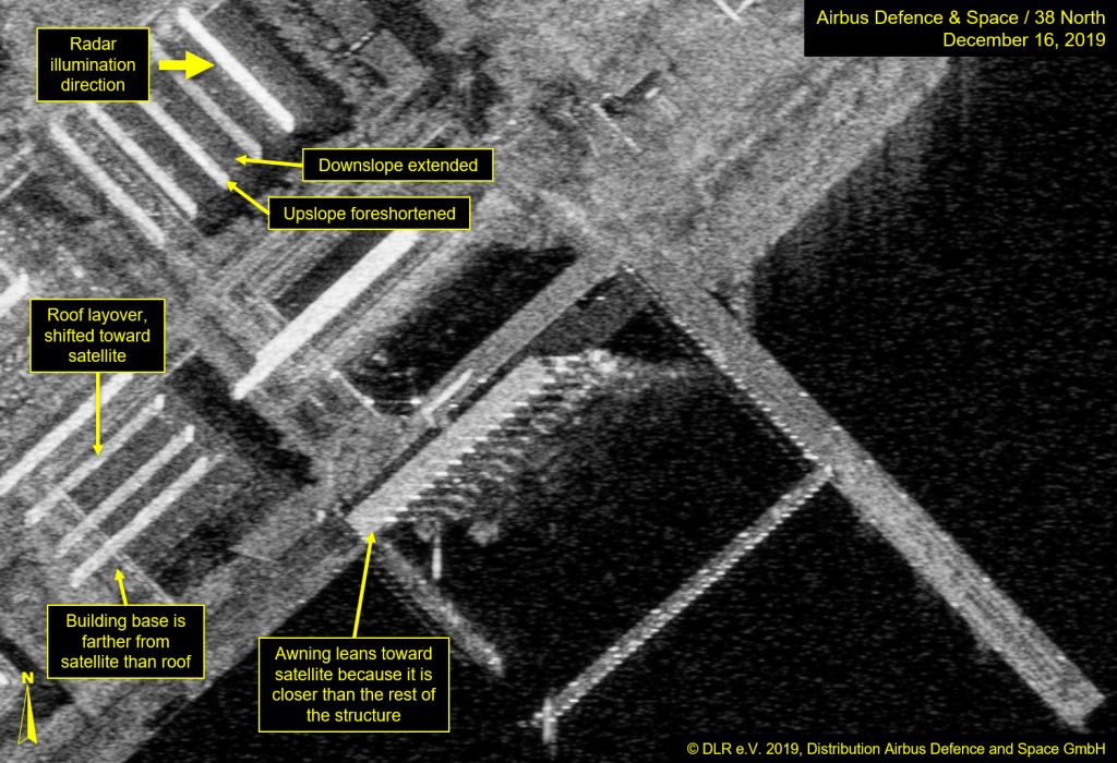
Figure 5. Strong layover effect visible in SAR imagery of test stand at Sinpo. (slides 7 & 8)
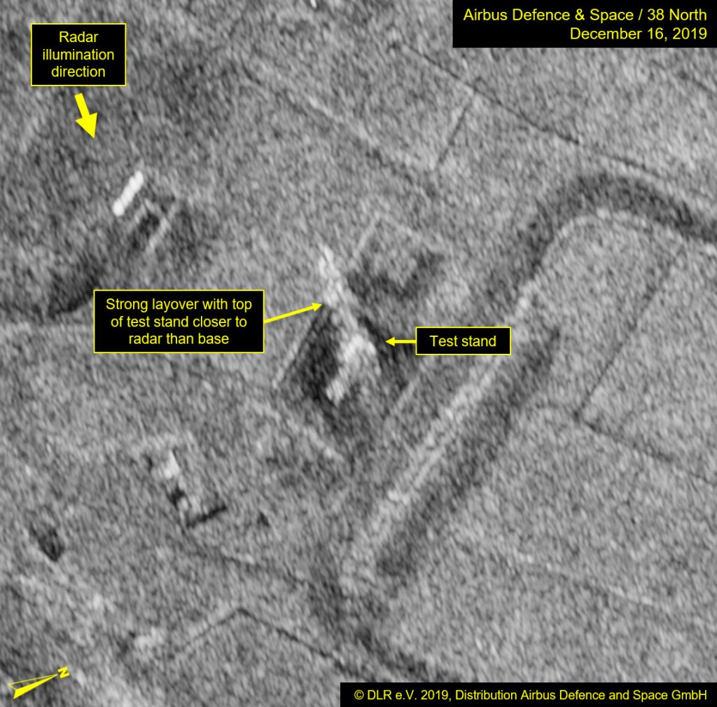
Image left © 2020 Planet Labs, Inc. cc-by-sa 4.0. Image right © DLR e.V. 2019, Distribution Airbus DS. For media options, please contact [email protected].
In conclusion, augmenting commercial satellite imagery analysis with SAR imagery can be useful for assessing the presence of otherwise hidden targets.