Sohae Satellite Launching Station: Service Roads Regraded
Recent commercial satellite imagery of the Sohae Satellite Launching Station indicates that, while there are no observable signs of preparations for either a rocket launch or engine test, the complex continues to be aggressively maintained. This includes regrading the entire existing network of dirt roads in the complex sometime after snow was cleared this spring, improving their serviceability and likely ensuring that the site remains ready for use. A few new connecting segments were carved out as well, but it is impossible to determine their purpose based on imagery alone.
Background
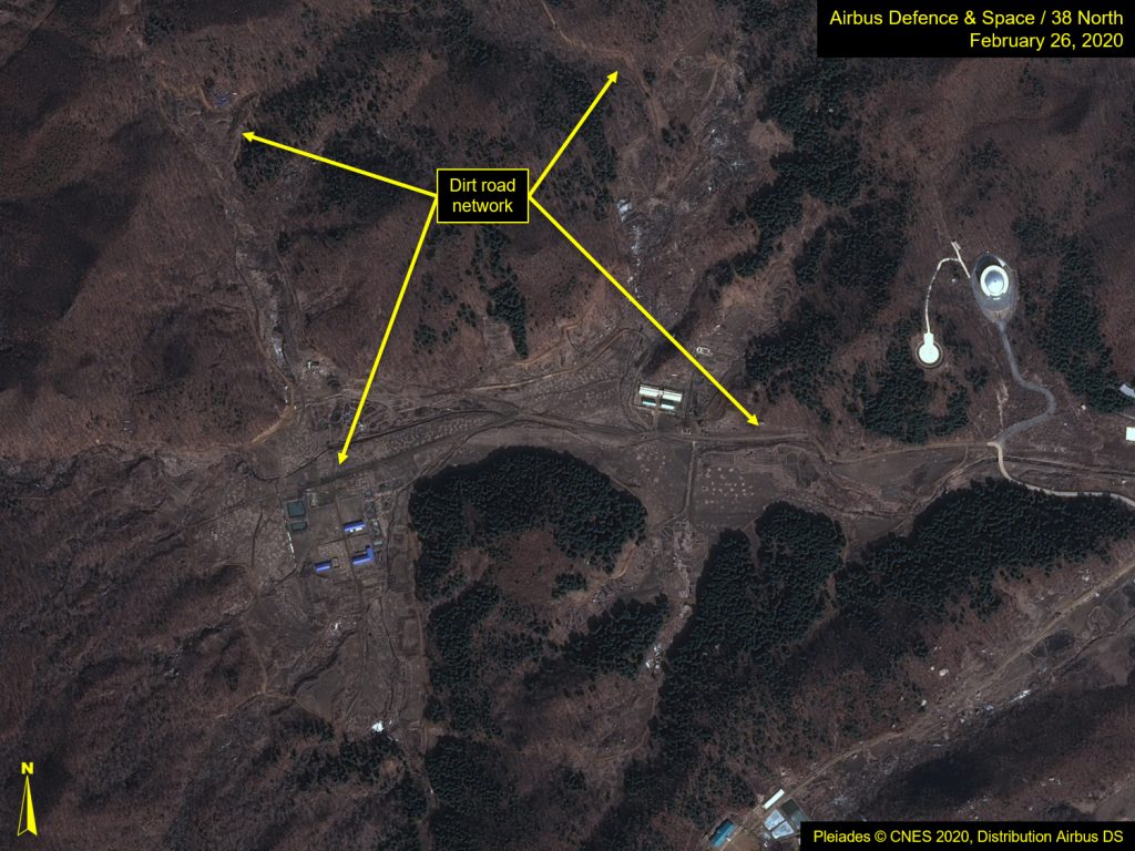
The facilities within the Sohae complex are connected by a combination of both paved and dirt roads. The paved roads support the main elements of the complex, connecting the Launch Pad and Vertical Engine Test Stand with several key support facilities such as the administration and security headquarters area, the Horizontal Assembly Building, the NADA administration and launch control building, the VIP housing area, the VIP Observation Facility, and the housing and support area. Portions of the dirt road network follow tree lines, suggesting they serve as interior security roads, while others wind their way to various outbuildings and onsite agricultural support areas.
Due to the mountainous terrain around the complex, erosion is a constant threat to the internal road network. Water runoff, particularly that which is generated by the winter snowmelt and frost heaves, can render segments of the network impassable or difficult to traverse. This is especially true where there is improper drainage on either side of the roadway, making washouts and ruts common.
Grading Activity
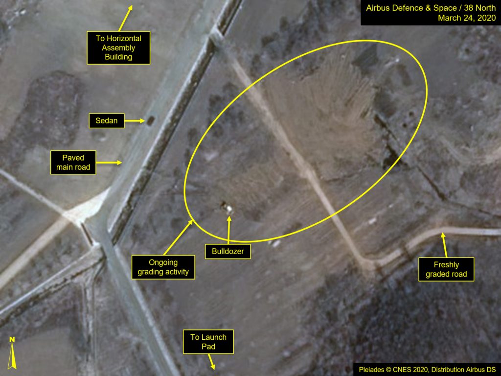
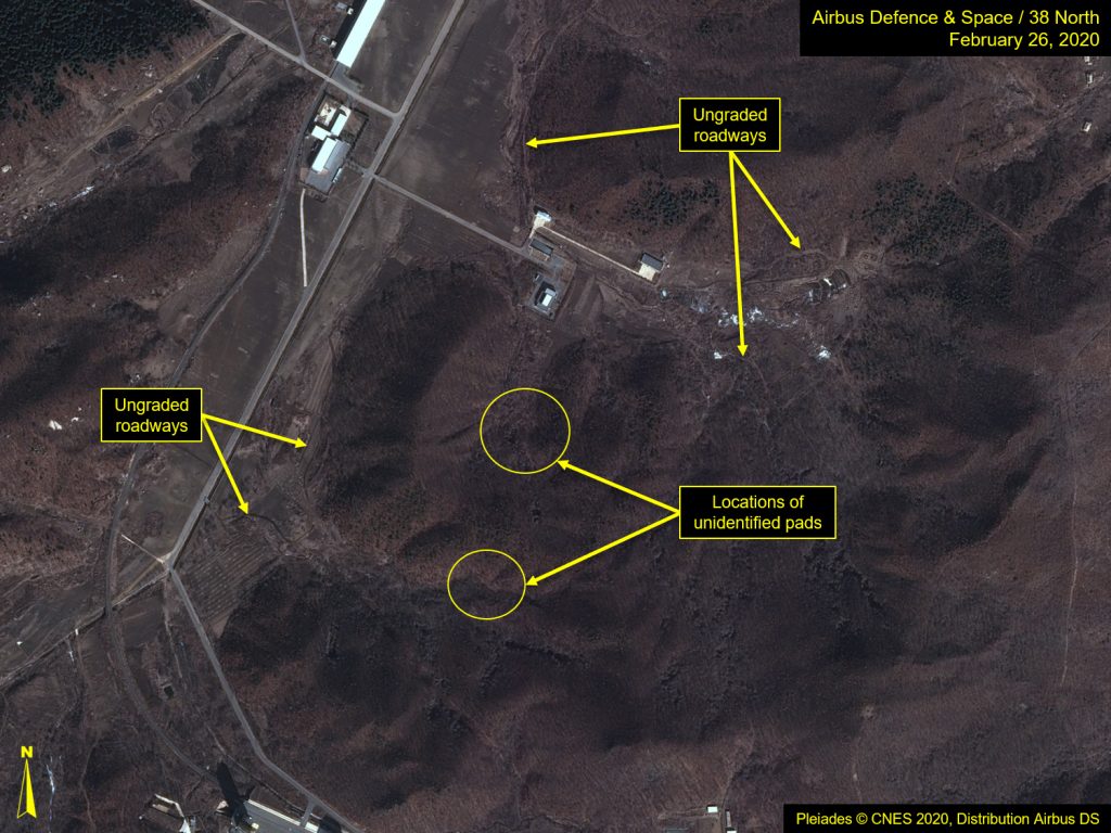
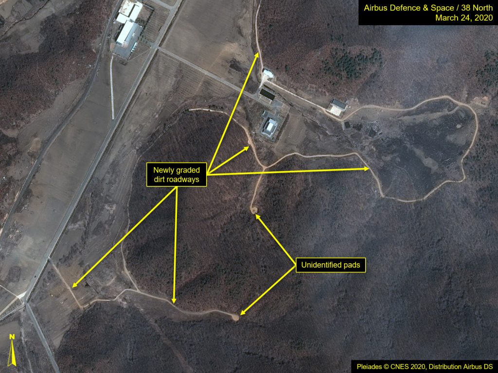
Sometime after the snow was cleared from the Sohae complex this spring, efforts to regrade the entire internal dirt road network were observed, with most of the work completed by March 20. In most cases, grading efforts followed the path of pre-existing dirt roads, however, a few new connecting segments were carved out as well. Notably, there are two regraded stem roads that now end with new circularly-graded “pads.” These stem roads originate from two separate areas: one from the former satellite control center and VIP housing area, and the other from the main paved roadway, just south of the Horizontal Assembly Building. A few smaller circularly-graded areas appear on the west side of the complex as well, along a couple dirt road segments.
The purpose of these pads is unknown; none are large enough to support the turning radius of a large vehicle, such as a mobile transporter-erector-launcher (TEL), and, therefore, are unlikely to be meant for launch support. Similarly, while their size and shape are conducive to instrumentation installations, their locations nestled within narrow valleys instead of at the top of hills makes this an unlikely use as well.
The regrading activity appears to be part of efforts to ensure the dirt road network is serviceable after a snowy winter, rather than any kind of facility expansion. It is interesting that personnel remain onsite and active while the country is dealing with COVID-19 containment measures, however, low-level activity has been consistently observed at Sohae and is not uncommon.
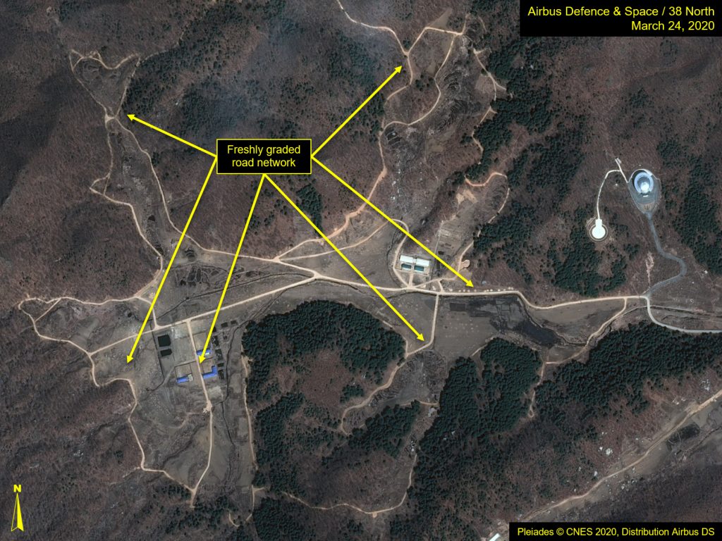
Figure 1. Overview of main road shows freshly graded road network.
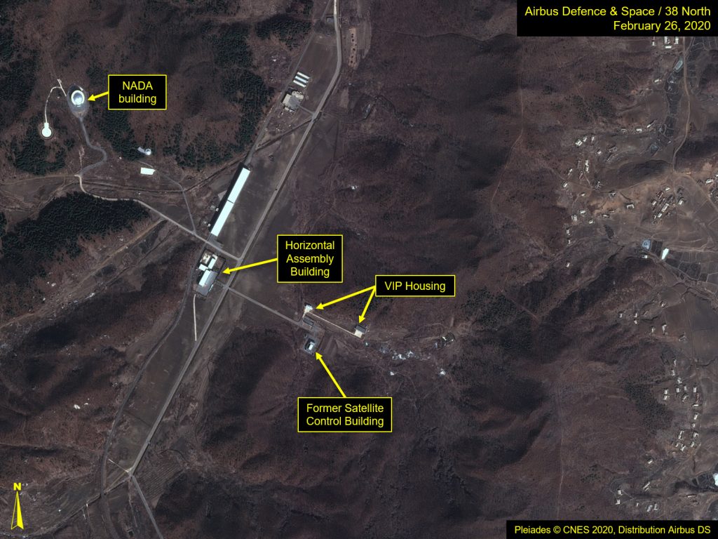
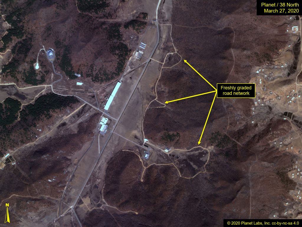
Image before: Pleiades © CNES 2020, Distribution Airbus DS. For media options, please contact [email protected]. Image after: © 2020 Planet Labs, Inc. cc-by-nc-sa 4.0.
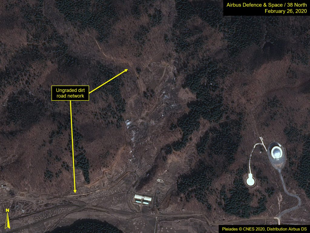
Figure 2. Freshly graded road network visible west of the main paved road.
Images Pleiades © CNES 2020, Distribution Airbus DS. For media options, please contact [email protected].
Figure 3. Close-up of freshly graded road network west of the NADA administration and launch control building.
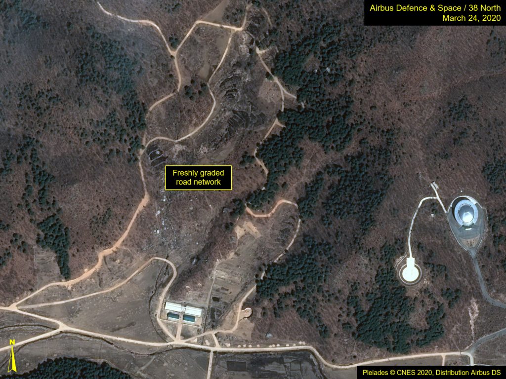
Images Pleiades © CNES 2020, Distribution Airbus DS. For media options, please contact [email protected].
Figure 4. Dirt roads freshly graded in the northeast corner of the Sohae complex.
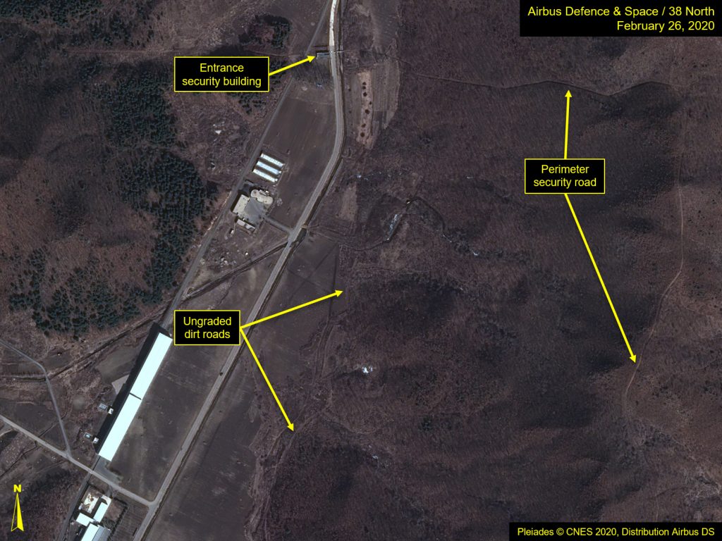
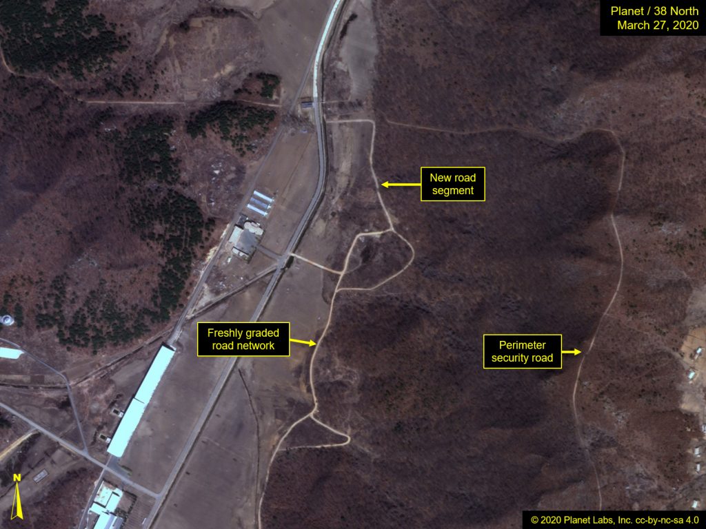
Image before: Pleiades © CNES 2020, Distribution Airbus DS. For media options, please contact [email protected]. Image after: © 2020 Planet Labs, Inc. cc-by-nc-sa 4.0.
Figure 5. Close-up of two regraded stem roads end with new circularly-graded “pads.”
Images Pleiades © CNES 2020, Distribution Airbus DS. For media options, please contact [email protected].
Figure 6. Bulldozer observed in close-up of ongoing grading activity.