Sohae Satellite Launching Station: New Southeast Seaport Rapidly Taking Shape
Commercial satellite imagery of North Korea’s Sohae Satellite Launching Station indicates that construction of the new southeast seaport has picked up pace over the past month, and considerable progress has been made. Additionally, the road from this port to the Sohae complex is becoming better defined as grading and road surface buildup continue.
Progress on other key facilities at Sohae, including modifications to the launch pad, has been slow in recent weeks. Completing the seaport, road and tunnel construction will make it possible for certain types of equipment or materials to be shipped to Sohae to support the modernization efforts.
Seaport Construction
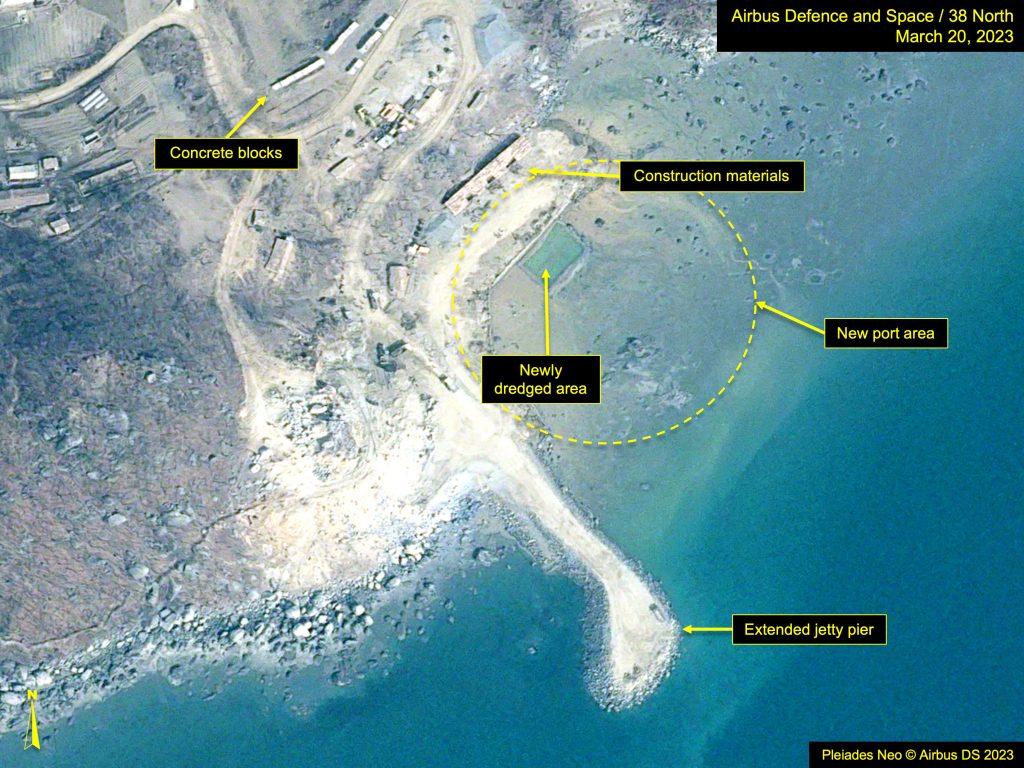
In imagery from March 20, the beginnings of a new quay were observed, and a rectangular area had been dredged at its center area, possibly to assess how much the harbor (formed by the jetty and quay) could be deepened to enable operations at low tide. Alternatively, this dredged area may have been prepared to lay the foundation for a future wharf. That image was taken during low tide, revealing a rocky coastline and shallow waters and the dangers they present to navigation.
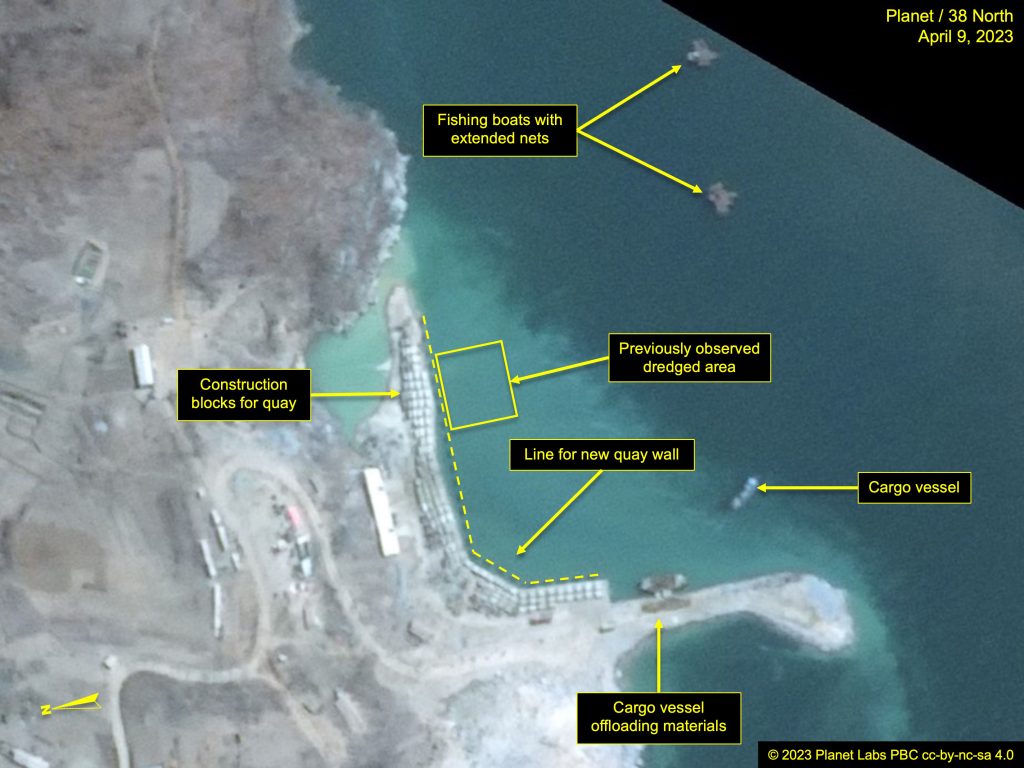
An April 9 image, capturing probable mid-tide conditions, showed the dredged area had since been filled back in with sediment. In order to prevent continual sediment incursion, a second parallel jetty to the east may be planned, which would extend sufficiently away from the coast to block adjoining sediment from entering and filling the harbor.
In the period between the two images, approximately 180 meters of quay wall has been added.
Additionally, on April 9, two fishing boats with nets extended and two small cargo vessels were present. One of the vessels was moored to the leeward side of the jetty with its gangplank lowered and unidentified material deposited on the jetty. By April 12, the fishing boats and the offshore cargo vessels had departed. One cargo vessel was moored next to the jetty, and two small craft were observed nested together offshore.
Connecting Roadway Construction
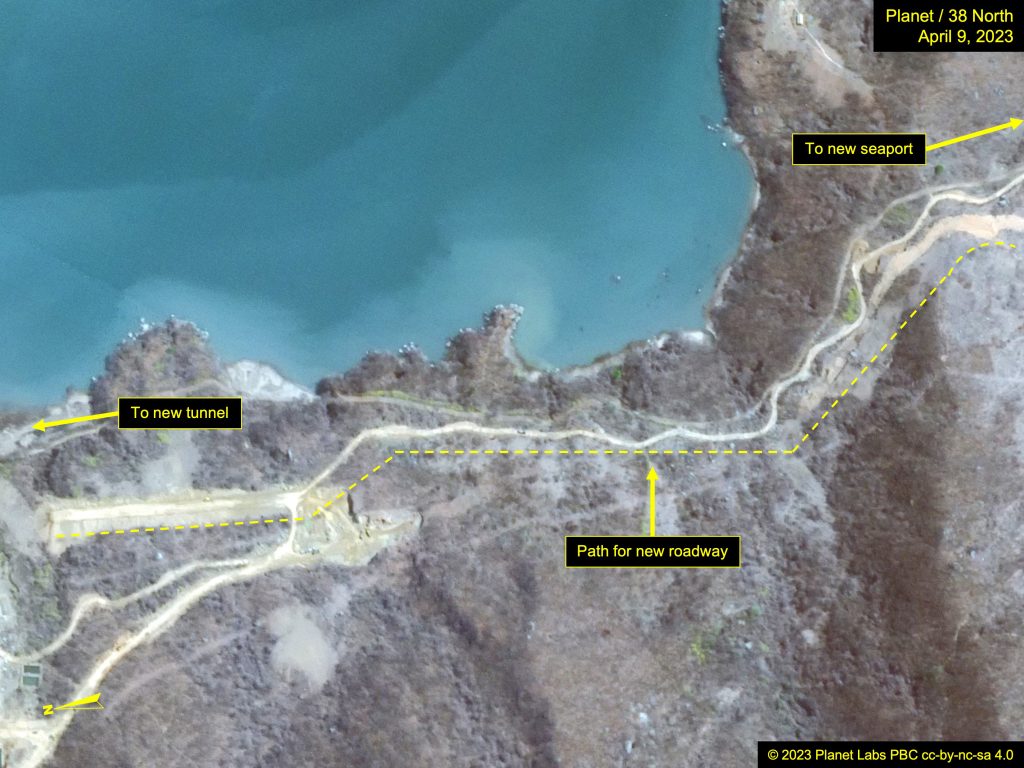
Construction on a new road, which will connect the seaport via a new access tunnel to the secure Sohae complex, is also progressing rapidly.
Presently, three roads follow the east coastline from the workers’ camp and fishing village south to the new seaport. The lower of these, and closest to the sea, is the original road. The second was established more recently and is presently the main route being used to transport materials south.
The third road can only be seen in sections. It is wider, less serpentine and slightly higher in elevation than the others. From the seaport extending north, its projected path is still incomplete, as grading has been done in sections. Presently, at its north end, the road surface is being built up in order to cross a small valley, where a bridge is likely to be added.
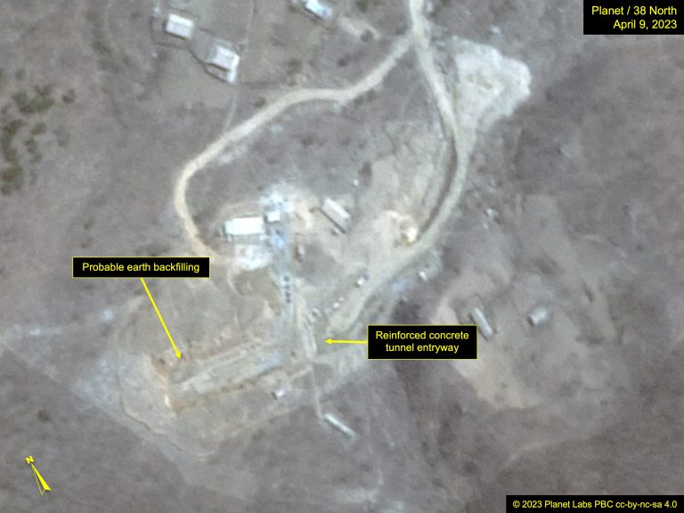
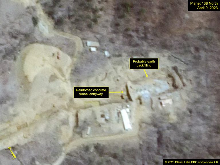
The Tunnel
Activity at the northwest and southeast entrances to the new tunnel appears to have subsided in recent weeks. By April 9, efforts to cover the concrete arched entryways to the tunnel appear to be underway, suggesting work on the entrances is nearing completion. The roadway to either side, however, remains incomplete, and the status of the tunnel’s interior is unknown.
Other Activity
The remainder of the construction projects within the complex, while continuing, have not progressed as quickly as the surrounding infrastructure.
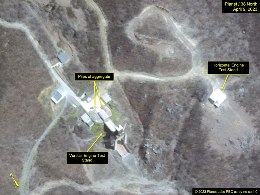
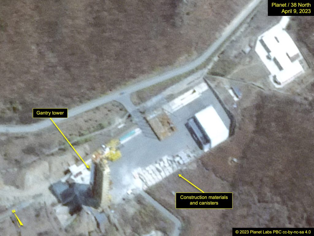
Few changes can be observed to the satellite launch pad and support buildings.
By last October, the fuel and oxidizer depots at the launch pad had been mostly demolished, possibly due to corrosion from the chemicals stored or a need for modifications to accommodate future uses. Between March 1 and April 9, some remaining debris was removed, and the grounds were groomed, although no new building construction appears to have begun.
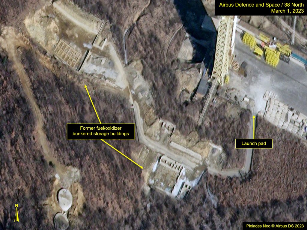
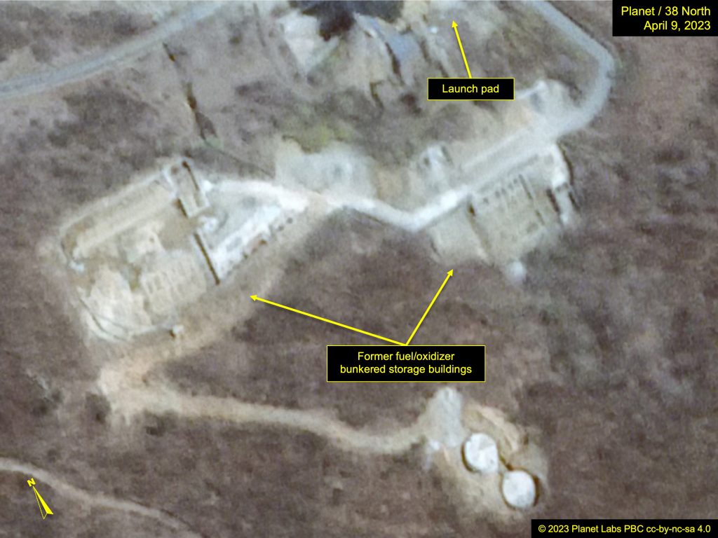
Figure 6a. Recent grooming of formal fuel and oxidizer depot areas on imagery from March 1, 2023. Image Pleiades NEO © Airbus DS 2023. For media options, please contact [email protected].; Figure 6b. Recent grooming of former fuel and oxidizer depot areas on imagery from April 9, 2023. Image © 2023 Planet Labs, PBC cc-by-nc-sa 4.0. For media licensing options, please contact [email protected].
Piles of aggregate remain on the pad of the Vertical Engine Test Stand (VETS), which may be material for road surfacing. Work on the large new support building located adjacent to the VIP housing continues, but the total footprint of the structure remains incomplete.