A Close-up Look at North Korea’s Digital Map App
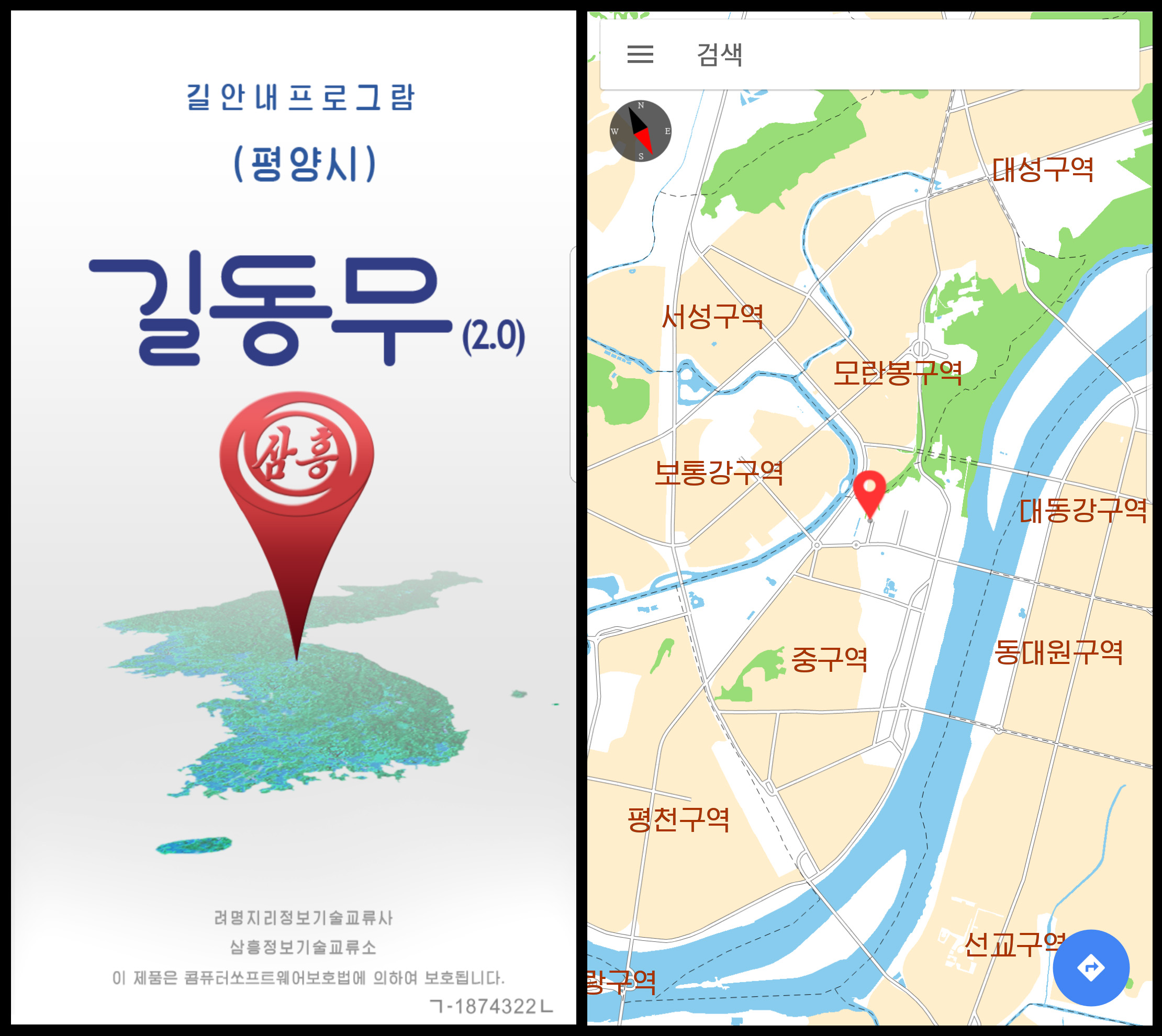
 Since around 2017, North Koreans with smartphones have had a new way to navigate around Pyongyang. An application (app) called “길동무” or “Fellow Traveler” offers a directory of the city and hundreds of shops, restaurants, hotels and other locations and might be the closest thing the country has to Google or Apple Maps. The app reviewed in this article was version 2.0 and carried a 2019 copyright notice. There is likely a newer version with different features currently in use, but there are still interesting insights that can be gleaned from this older version.
Fellow Traveler is a good example of how North Korea’s smartphone ecosystem is developing, in many cases in parallel with similar apps that exist overseas but with unique local characteristics or restrictions.
Unique Characteristics
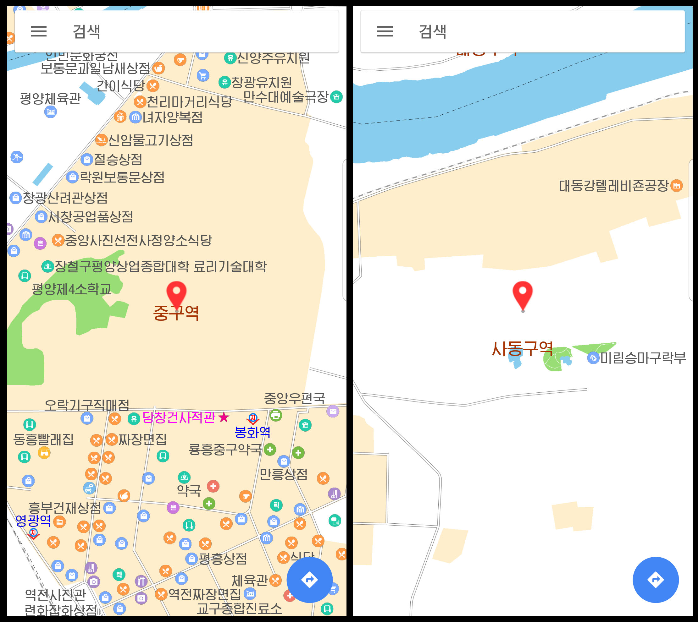
One key difference between North Korea’s “Fellow Traveler” app and other mapping apps is that it does not actually use GPS satellite navigation. This is likely due to security concerns about giving citizens access to accurate geolocation data. Instead, when the app starts, it shows a map of central Pyongyang with a pin sitting just behind the Supreme People’s Assembly building. The user has pan, scroll and zoom functions to find their current location and where they want to go. To aid in direction finding, there is a small compass in the corner of the screen.
The app also doesn’t cover the entire country or even the entire city. Version 2.0, for instance, extends approximately seven kilometers north and south of the Supreme People’s Assembly building and about nine kilometers east and west.
Finding Places
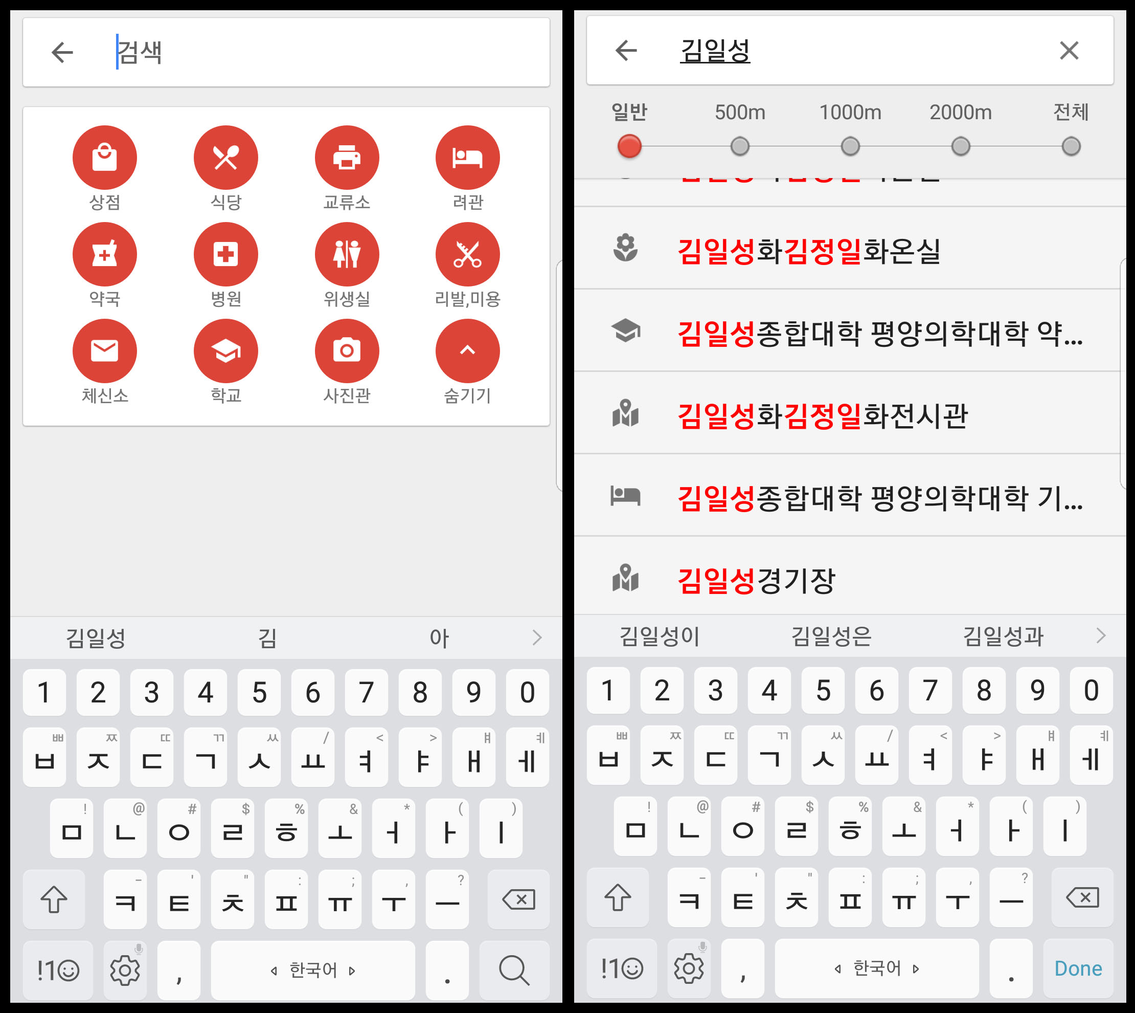
Places can be found by scrolling around the map or using a search interface. Users can either type the name of the place they are looking for or select a type of establishment, and the app will provide a list of matching places near the map pin.
The filters included: shops, restaurants, exchange stores, hotels, pharmacies, hospitals, restrooms, beauty shops, post offices, schools and photo studios.
Users can also either drag the pin to a location or search for a location. In the screen below, the names of Kim Il Sung and Kim Jong Il are represented in red to make them stand out. This is similar to how North Korean websites and media use a slightly bolder or larger font when they are mentioned.
Finding a Route
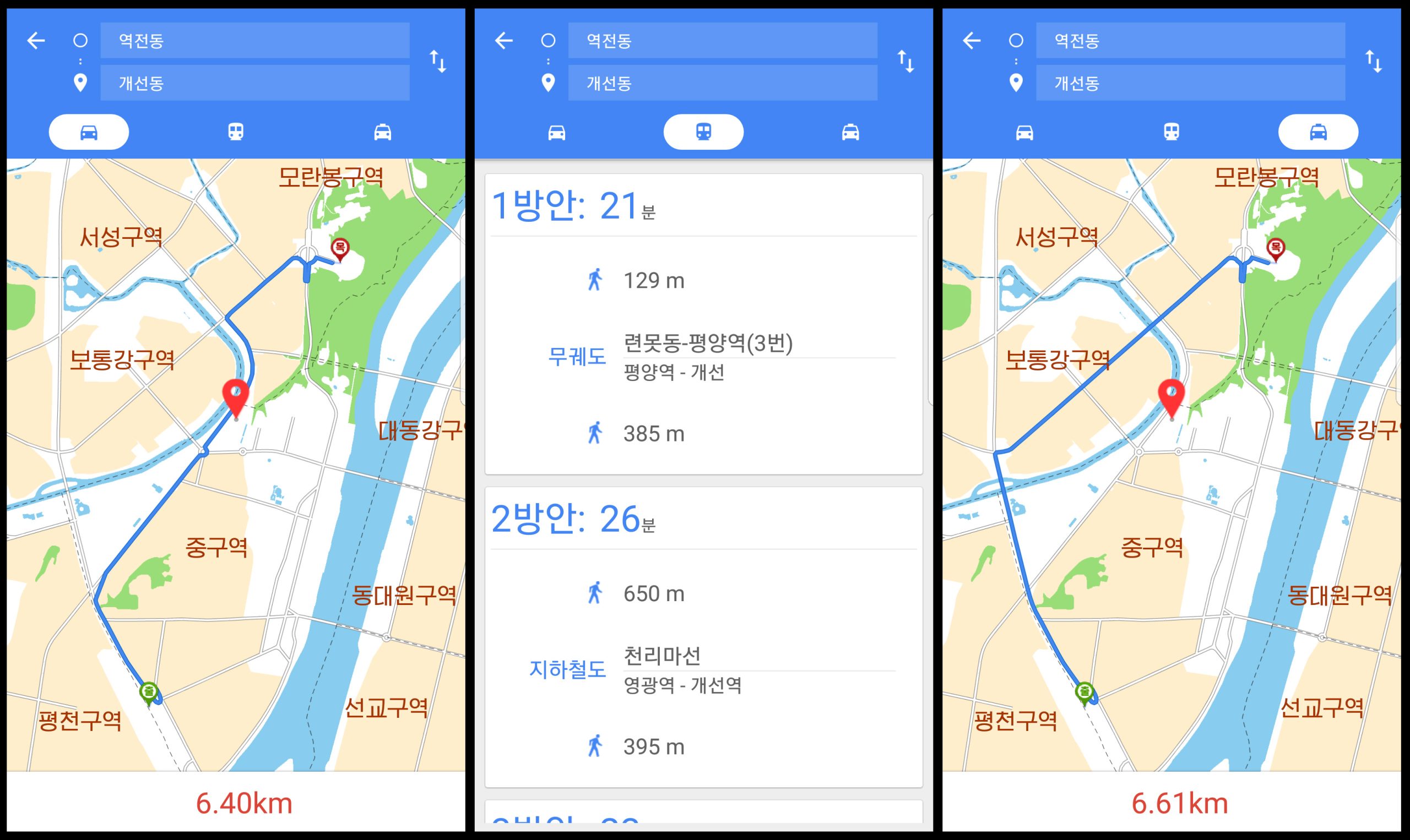
The app offers directions for public transport, car or taxi.
In the example below, a route is plotted from Pyongyang Station to the Kim Il Sung Stadium. Three transit routes are found, the shortest of which takes 21 minutes and includes just over 500 meters of walking. Car and taxi routes are also provided and take slightly different routes.
Map Data
Mapping data is sensitive in both North and South Korea for security reasons related to the unique status between the two countries. In the South, the government mandates domestic data must be kept within the country, resulting in the hobbling of some features on Google and Apple Maps.
In the North Korean app, mapping data exists for most of the covered portion of Pyongyang and includes hundreds of shops, restaurants, public buildings and other organizations. The help file for the app says the map data was current as of March 2018.
However, not everything is detailed. In addition to numerous buildings having no labels, sensitive areas of the city, such as the Korean Workers’ Party complex in central Pyongyang and the Mirim Parade Training Ground, have no details, roads or building outlines.
Developers
The start-up screen for the app credits two companies: Ryomyong Geographic IT Exchange Company and the Samhung IT Exchange Company.
While the former company is otherwise unknown, Samhung IT Exchange Center (Samhung Economic IT Center) has received previous coverage in North Korean state media.
The company develops Android apps and was named one of North Korea’s top 10 IT businesses in both 2017 and 2023.
A profile in state media said it was established in 2012 and has created several popular apps, including “My Companion,” an app containing several hundred electronic books, and an electronic payment app called “Samhung Electronic Purse.”
Users appear to be able to directly reach the developers from the app. A feedback page in the app allows messages to be sent to the developers to report errors, problems or send suggestions.
Samhung IT Exchange Center is located in central Pyongyang, just a block from Kim Il Sung Square, according to the app. Ryomyong Geographic IT Exchange Company is located 4.5 kilometers to the north in a tower block in the Ryomyong Street development, also according to the app.
Other Versions
An older version of the app, version 1.1, was previously detailed by Alek Sigley, an Australian student who previously lived in Pyongyang while studying at Kim Il Sung University. Comparing screenshots of the earlier version with version 2.0, it appears the newer has more data and a refreshed interface.
One interesting aspect of the app is a time limit on its use, presumably tied to getting users to upgrade to newer versions. The app is programmed to run only until the end of 2018. Once the clock in the phone hits 2019, the app refuses to run.
It is likely that Samhung IT Exchange produces updated versions that run for a year or two before requiring an update.