Quick Take: Large Trenches Across Former Border Links
Commercial satellite imagery shows that two large, well-defined trenches now slice through the land that once carried roads and railways that linked North and South Korea. The work began almost immediately after North Korean troops demolished the border links on October 15. As of October 30, construction continues.
West Coast Route (Asian Highway-1)
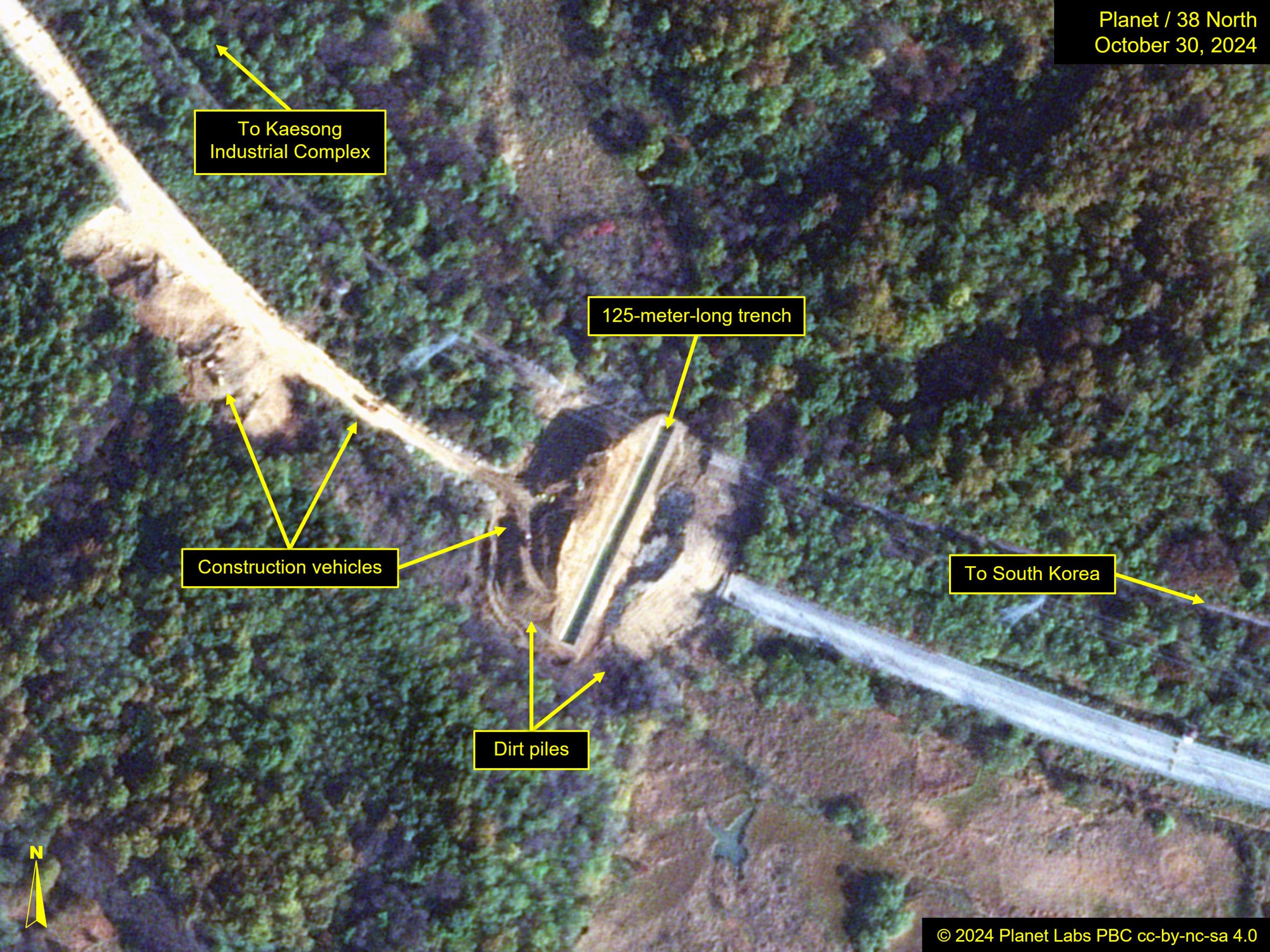
At the west coast crossing, which connected South Korea to the Kaesong Industrial Zone (also written as Kaesong Industrial Complex), a 125-meter-long trench has been dug perpendicular to the road, a few meters past the military demarcation line (MDL) that divides the two countries.
The trench measures approximately seven meters wide, and large piles of dirt sit on either side of it. The purpose of the trench and dirt is unclear beyond it being some type of blockade that is intended to sever the transportation links. The mound could be part of the barrier, or it could be a temporary product of the construction work.
East Coast Route (Asian Highway-6)
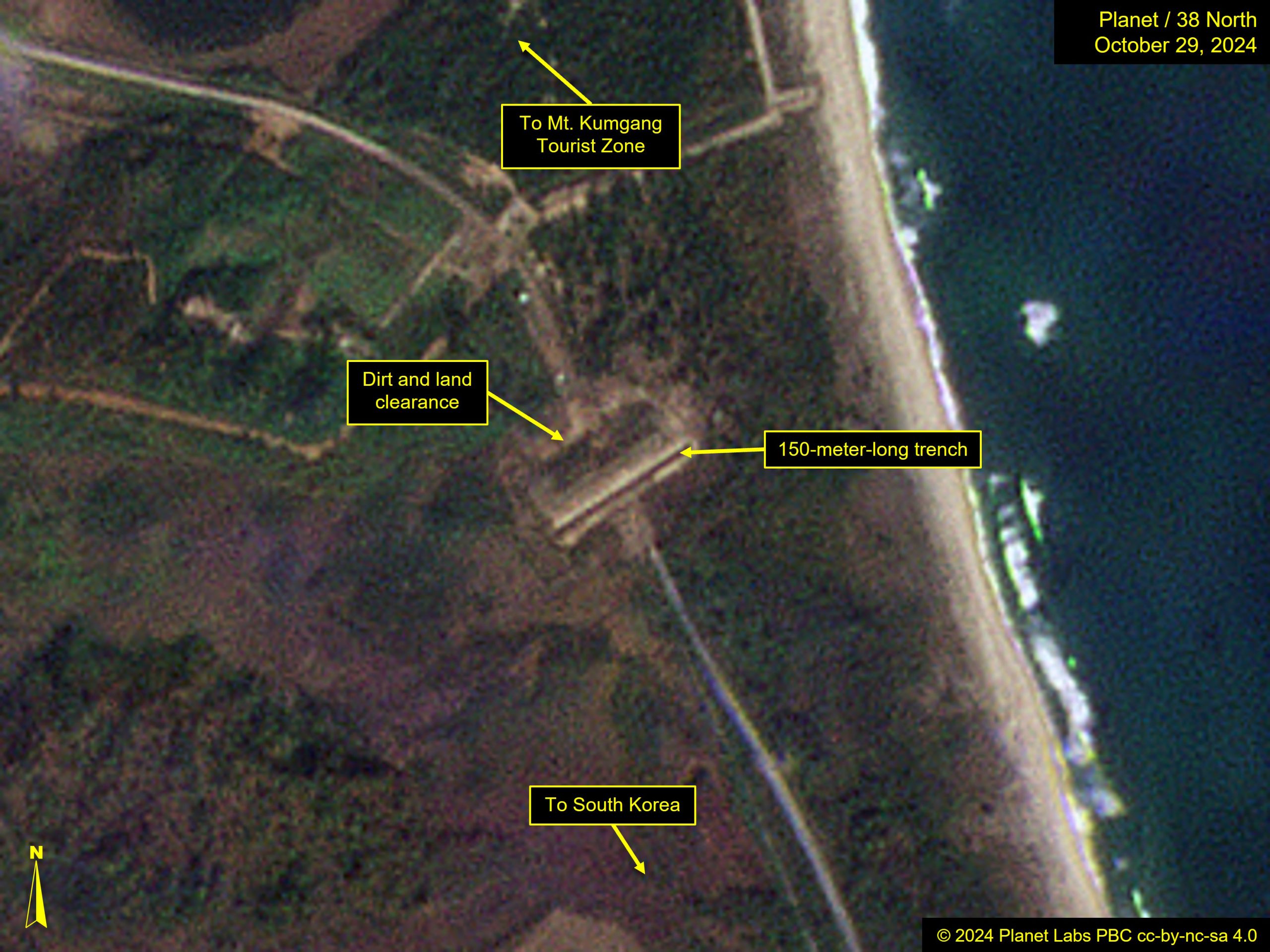
The east coast crossing—previously connecting South Korea and the Mt. Kumgang Tourist Zone—has similarly been bisected by a large trench.
Medium-resolution satellite imagery does not reveal the same level of detail as imagery of the AH-1 crossing, but the trench is clear. It is slightly longer at 150 meters and differs from the trench at the west coast crossing in that dirt and land clearance are only observed on one side of the trench.
Continued Work
Several trucks are still visible at the west coast, indicating that work is not yet complete. As construction efforts continue, we may gain more understanding about the reason for the trench and how North Korea intends to seal these two border crossings.