North Korea’s Hwangju-Kindung Waterway Project
Overview
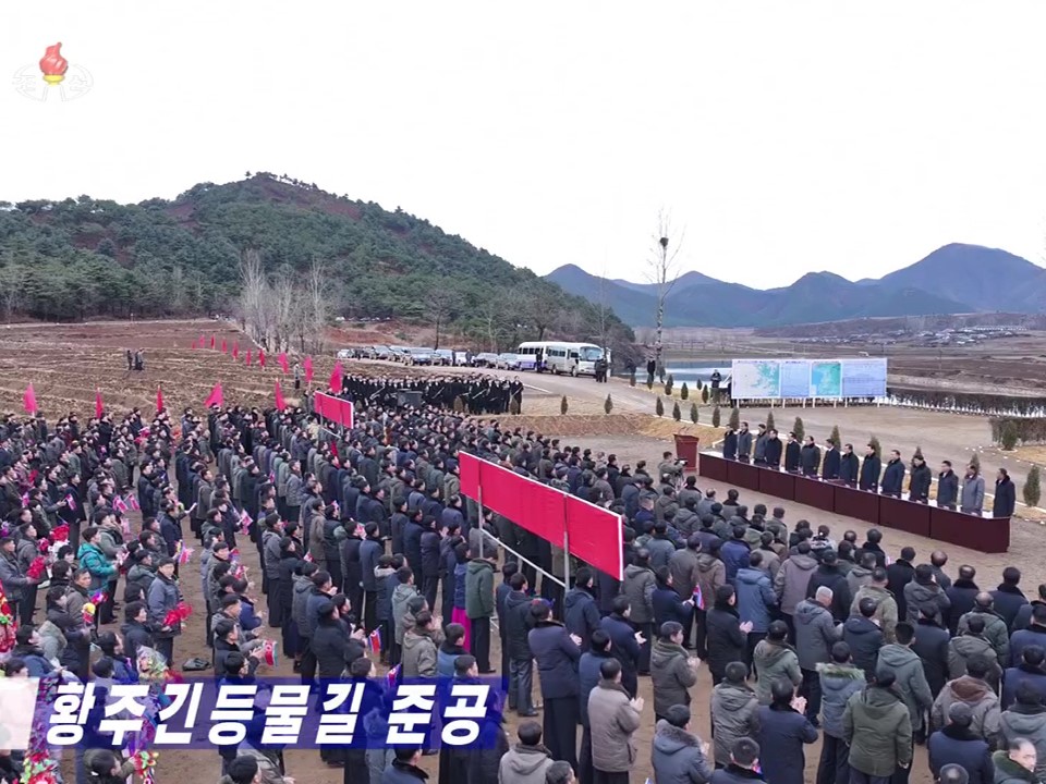
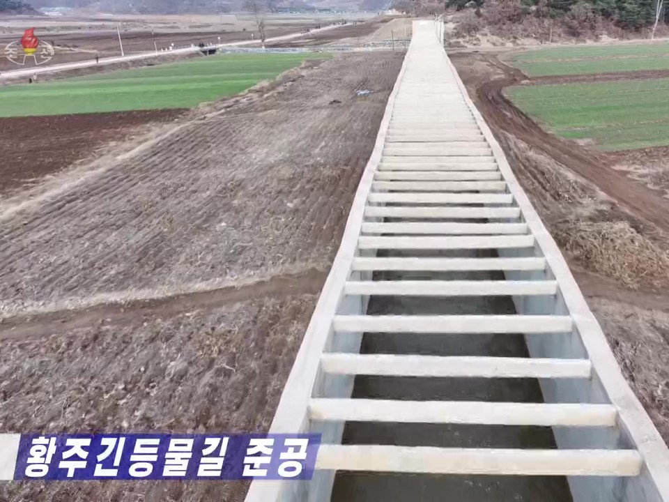
The Hwangju-Kindung Waterway was officially declared operational in December 2023. This new gravity-fed waterway system aims to provide a constant, uninterrupted water supply to the Hwangju-Kindung Plain for crop irrigation. It will reduce the region’s dependence on electrical pump stations that require constant electricity supply.
Completion of the Hwangju-Kindung Waterway was also noted as fulfilling North Korea’’ rural development and irrigation construction goals set at the Eighth Party Congress. Whether the new waterway will work as designed remains to be seen, as the system has yet to be tested during the extremes of the country’s wet and dry seasons.
Activity
Background
Of North Korea’s 46,541 square miles, approximately 80 percent of the land mass is mountainous or tablelands, leaving the remaining 20 percent suitable for agriculture. Climatically, summer tends to be hot, humid and rainy. Winters, particularly in the mountains, alternate between clear, dry weather and heavy snows when the moist sea air freezes.
As discussed previously, North Korean diets are generally plant-heavy, even amid efforts to expand protein farming. In both cases, optimizing conditions for both protein and agriculture is necessary to maintain food supply.
While the land is rich in mineral sources, only the lowlands—principally on the country’s west coast—are suited for agriculture. These farmlands must be carefully managed given North Korea’s relatively short growing season, which can be plagued either with excess rain or drought. Land reclamation efforts have been used to help increase crop production and ensure the existing lowlands receive the right amount of water through a system of irrigation canals, including the coastal, rice-producing lands and areas further inland that might otherwise suffer through seasonal wet and dry conditions.
To ensure steady sources of water, North Korea has constructed numerous reservoirs at higher elevations, capturing snowmelt and water runoff during the rainy season. As water is gradually released from these reservoirs, it feeds into streams and rivers down to the lowlands, where water is diverted into crop fields via a network of canals and pumping stations. There are approximately 20 of these canal waterway networks of differing lengths. The majority of these waterways are located in the west and southwest provinces, while a handful are principally tunnel waterways located in the higher elevations of the north and northeast of the country. The latter originate from mountain reservoirs in the west, thus indirectly supporting the network of waterways there. Others flow to the east, feeding into other reservoirs or directly into rivers from which water is drawn for irrigation of the smaller crop fields located along the east coast. The latter rivers tend to dry up during the dry seasons. The tunnel waterways are intended to provide a more constant supply of water to meet agricultural needs.
The use of pumping stations, however, brings about an additional challenge—namely, a lack of consistent electricity supply. In a creative effort to ease this challenge, North Korea has undertaken an effort to utilize more “gravity-fed” waterways to channel water to the agricultural regions, reducing the need for electrical equipment.
The largest of these efforts began in South Hwanghae Province in January 2012 and was completed in May 2020. According to state media, this is “the largest gravity-fed irrigation network,” spanning “well over a hundred kilometers” and able to “supply enough irrigation water to tens of thousands of hectares of farmland.” Coverage of this project emphasized that this network uses minimal electric power and pumping equipment while still being able to supply enough irrigation water to ensure stable yields, prevent drought and flooding, develop fish farming, and “provide people with a pleasant cultural recreation environment.”
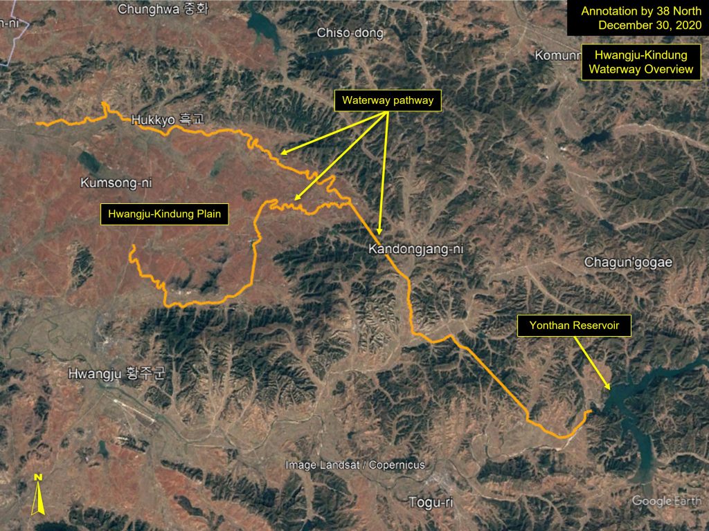
While the initiative in South Hwanghae Province is touted as the largest of these systems, most recently, North Korean attention has turned to the Hwangju Kindung Waterway, located approximately 35 kilometers south of Pyongyang.
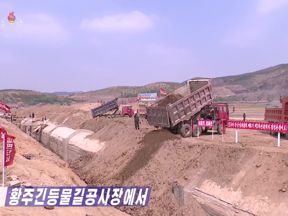
This project began in early June 2020 and was reported complete in December 2023.
The project is key to boosting grain production in North Hwanghae Province through a new gravity-fed irrigation system, which feeds into the Hwangju-Kindung Plain.
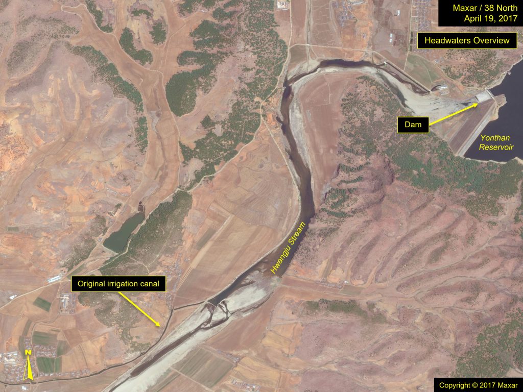
It replaces the previous canal system, which drew water from the Hwangju Stream (river), approximately 7 kilometers south of the plain, but separated from the river by a mountain range, through a series of pump stations, thus alleviating challenges associated with electricity supply.
Reports on the waterway’s completion tout the “vast fields of Hwangju and Yonthan counties” have been “turned into fertile land to be fully irrigated and rich land capable of producing stable yield despite abnormal weather.” Completion of the Hwangju-Kindung Waterway was also noted as fulfilling rural development and irrigation construction goals set forth at the Eighth Party Congress.
The Topography of the Hwangju-Kindung Plain
Located well above sea level, the Hwangju-Kindung Plain is a relatively flat region nestled between mountains to its north, east, and south. While the mountains provide a source of water from mountain springs, snowmelt, and seasonal rains, the elevation causes water to pass through rapidly, leaving the region arid. This is of particular concern during the dry seasons.
In contrast, areas of lower elevations allow for easier capture of water for irrigation due to slower, more serpentine pathways.
To combat the rapid runoff of water, North Korea created a series of canals and small reservoirs on the plain and draws water from the Hwangju River via a series of canals and pump stations, but at a steep cost as it draws from the country’s poor power infrastructure.
The Waterway Design
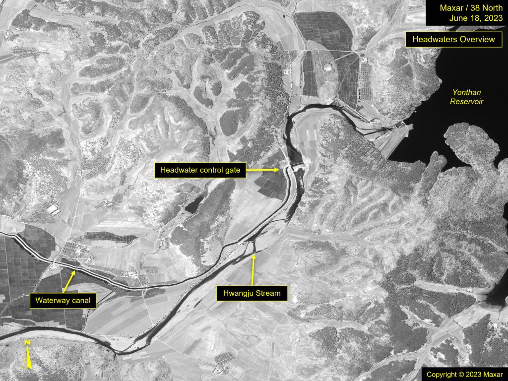
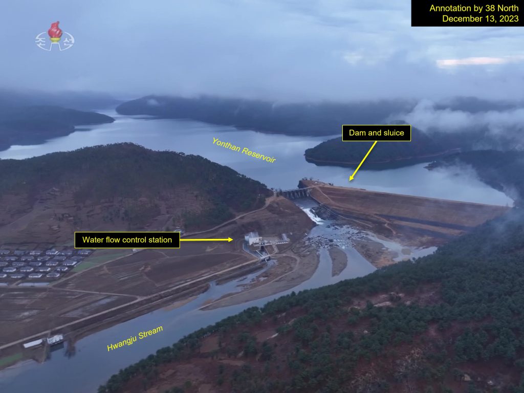
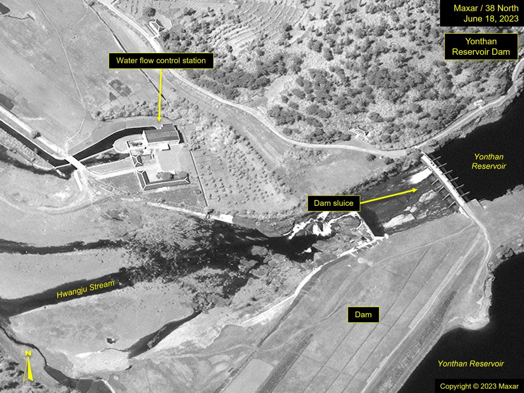
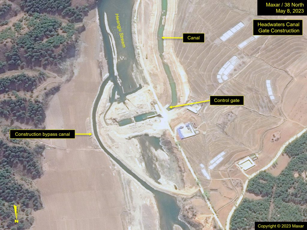
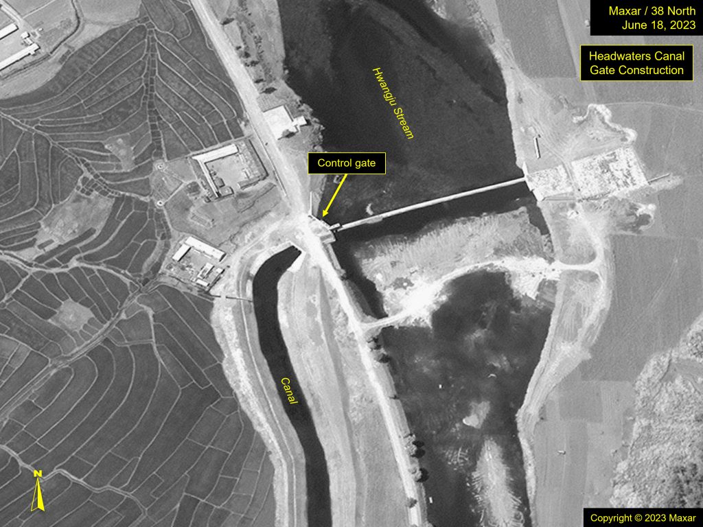
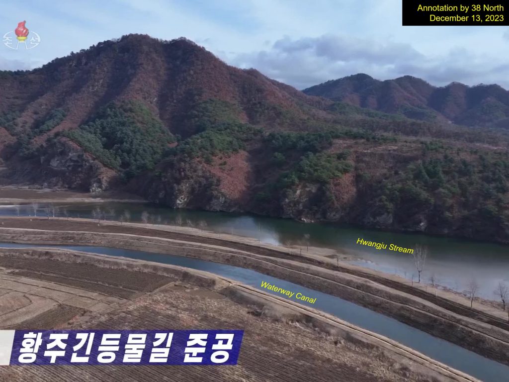
The Hwangju-Kindung Waterway is sourced from the Yonthan (Yontan) Reservoir. Approximately 1.5 kilometers downstream from the reservoir dam’s sluice, a secondary dam has been constructed to divert water from the river into the waterway’s canal system. This dam is of a flow-over design, which allows the river water to easily pass over the low dam and keep excess water from entering the waterway, thus maintaining a constant, even volume of flow. This is particularly important during the wet season when more water is released from the reservoir. During the dryer season, the canal can take in as much water as needed, independent of the river’s water level. A gate and gatehouse located at this juncture serve as a control valve.
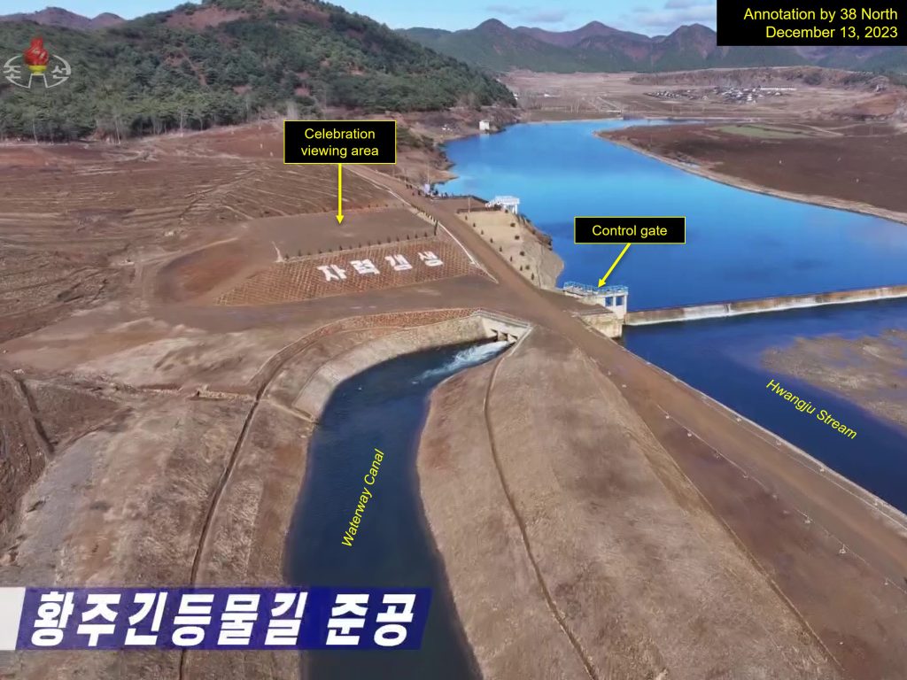
The canal parallels the river for approximately 1.7 kilometers before turning to the northwest.
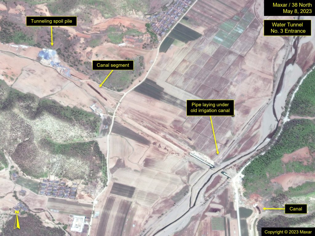
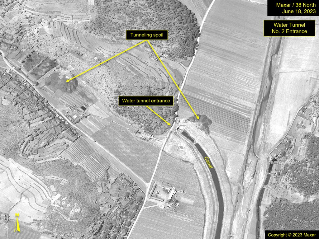
It is there that the first of the water tunnels begins to take the water to the Hwangju-Kindung Plain. Unlike the surrounding topography, where elevations are continuously changing, the grade of the tunnel’s descent is gradual, thus controlling the speed and amount of the water flow. The path of the tunnel, while underground, is easily followed as spoil piles (deposits of excavated rock from within the tunnel) appear along its route.
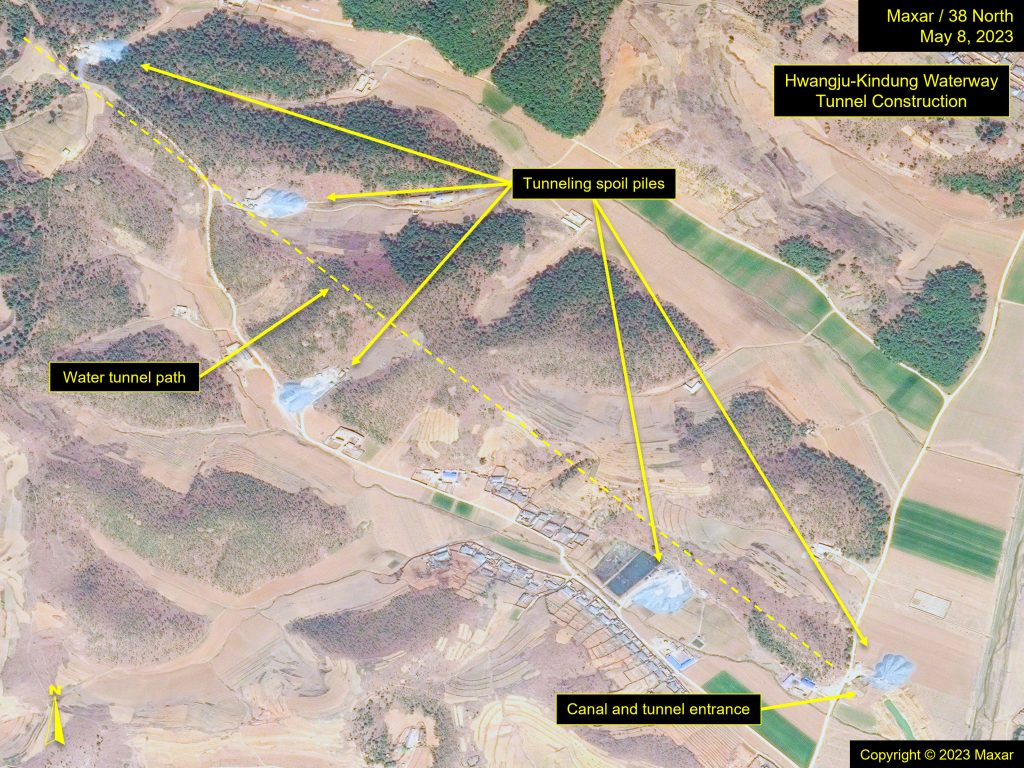
The first tunnel is approximately 5 kilometers long and emerges in a river valley where an open canal begins to wind its way another 6.5 kilometers before reaching the next tunnel entrance.
It is worth noting that at both this location and once on the plain, the waterway canals do not follow straight paths, but rather are circuitous. Though difficult to discern from commercial satellite imagery, this irregular pathway of the waterway is necessary to accommodate the dramatic topographic and elevation changes to keep water flowing at a constant speed and volume.
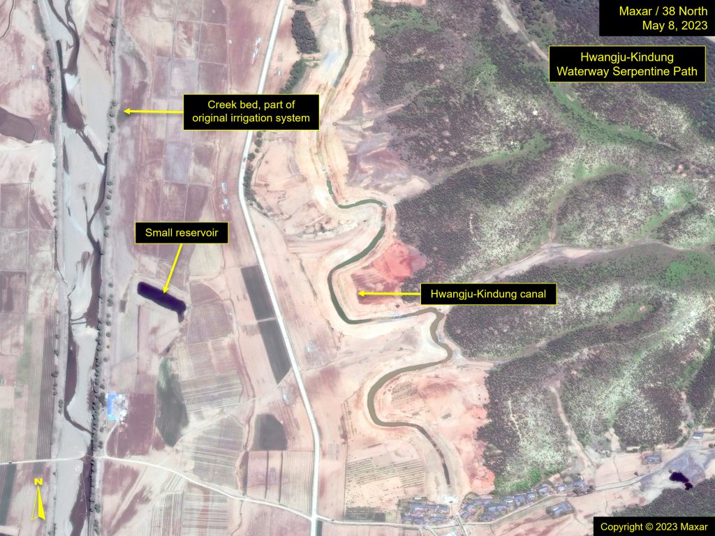
A similar example of this concept is a mountain hiking trail. If a trail were to go straight up a mountain from its base, the climb would be too strenuous for the hiker. Instead, hiking trails tend to take a more gradual, serpentine route up the mountain, making the climb and descent less strenuous.
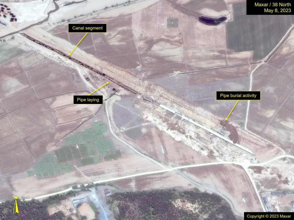
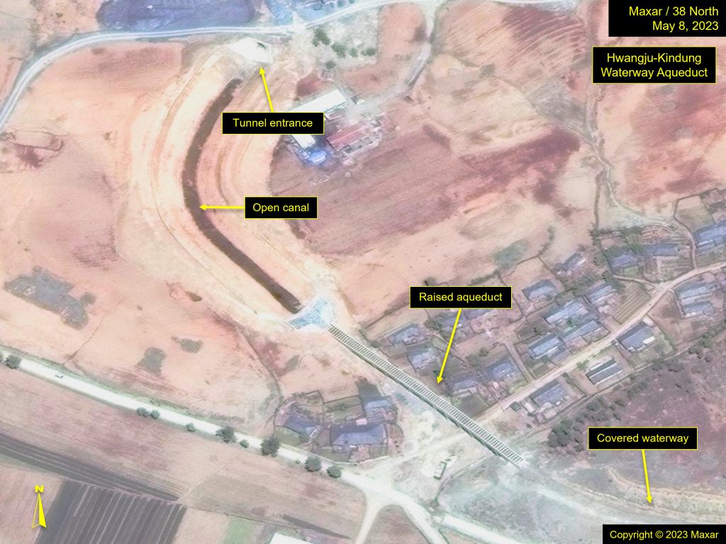
In addition to the serpentine path and the incorporation of water tunnels, water pipes are also buried, which allows for the waterway to pass under obstacles–-like former irrigation ditches and steams—while keeping the descending gradient constant. When the waterway needs to pass over lower-elevation features, such as streams or villages, aqueducts are employed.
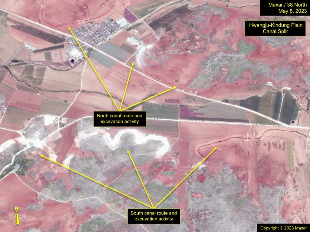
The second tunnel extends approximately 4.65 kilometers through the next range of mountains and emerges onto the plain, where it splits off in two westerly directions: one runs along the south side of the plain, and the other traces a path along the north side. The north canal extends for around 20 kilometers, and the south canal around 18 kilometers. Neither are continuous canals. Instead, each canal contains segments of buried water pipes where the terrain becomes too steep and passing under those high topographical features becomes necessary to maintain the constant gradient of the waterway.
The plain itself is crisscrossed with existing canals that were part of the original network that drew water from the Hwangju River located to the south.
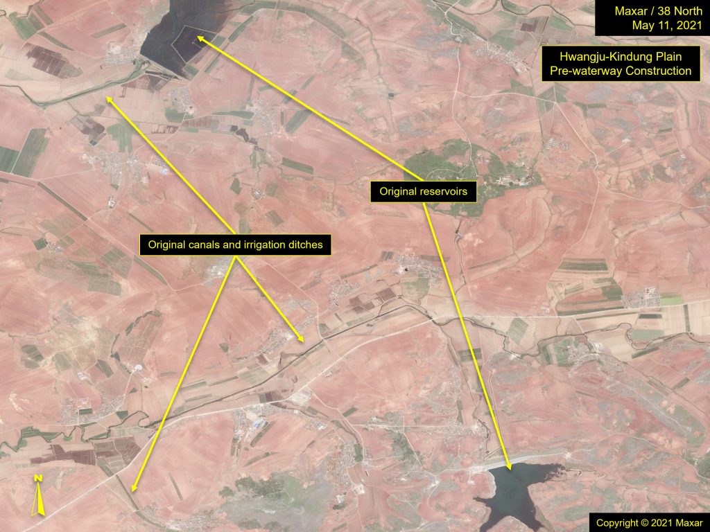
The plain also has a number of small reservoirs that were used to store water in anticipation of dry periods. Both of these features have been incorporated into the new Hwangju-Kindung Waterway system.
Look Ahead
Now completed, much reliance will be placed on the success of this unique and innovative means to supply water for irrigation to a region whose agricultural output is important to a nation striving to increase its food stores and become self-reliant from import markets. Whether this gravity-fed system will be successful and whether other such projects will commence merits watching, and includes the following:
- Evidence of continuously filled irrigation canals.
- The addition of new canals and evidence of failed irrigation pathways.
- Lush fields showing healthy crops.
- Low reservoir water levels.
- The construction of new gravity-fed waterways being built in similar, high-elevation agricultural farmlands.
- New ways that North Korea will try to reduce its reliance on a consistent electricity supply while continuing development in key sectors.
Data Sources
kml Hwangju-Kindung Waterway Path
shp Hwangju-Kindung Waterway Path
The Stimson Center and the National Geospatial-Intelligence Agency partnership uses unclassified imagery and data to produce new, timely, and accurate reporting on the North Korean economy. For more info, read the Tearline Project Explainer.
To read more, visit NGA’s Tearline article or download the Tearline app from the Apple Store or Google Play.
This content also syndicates to the Office of the Director of National Intelligence’s website intelligence.gov, which is a transparency effort to better explain certain strategic and humanitarian IC missions to the public.