North Korea’s Punggye-ri Nuclear Test Site: Evidence of Typhoon Damage
Recent commercial satellite imagery of North Korea’s Punggye-ri Nuclear Test Site revealed significant storm damage to the road that runs the entirety of the complex area. Floodwaters have washed out several sections of the roadway, limiting access to the site. However, the few remaining buildings on site (post-May 2018 demolition of the Main Administration Support Area) appear to have been spared.
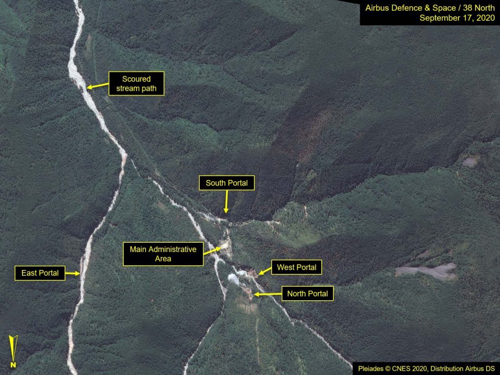
While the floodwaters have receded, imagery from September 17 revealed that the streambeds, which originate in the surrounding mountains and join near the portals area, before continuing through the valley toward the town of Punggye-ri, have been severely scoured, significantly widening their paths. This has destroyed bridges and several sections of the roadway, which run parallel to these streams.
There is no evidence yet of efforts being made to repair the roads in order to regain access to the site.
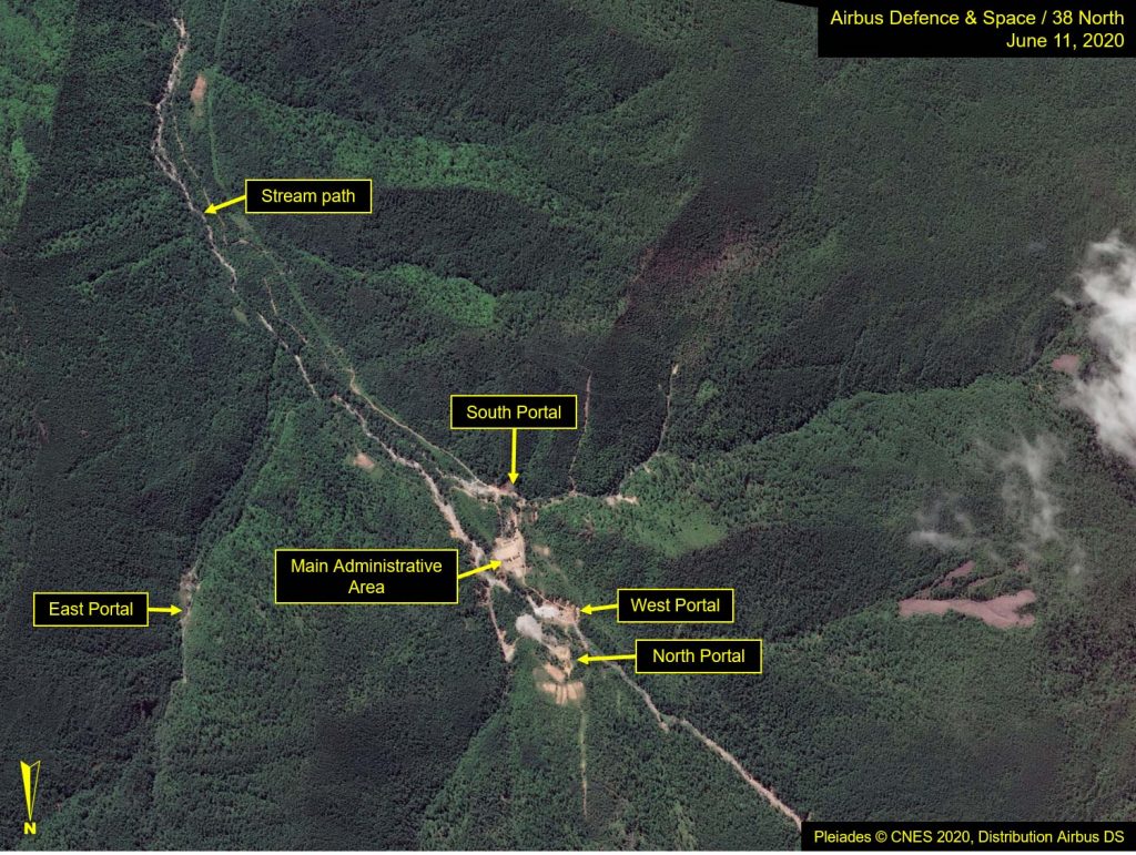
Figure 1. Overview of Punggye-ri Nuclear Test Site.
Images Pleiades © CNES 2020, Distribution Airbus DS. For media options, please contact [email protected].
Portal Areas
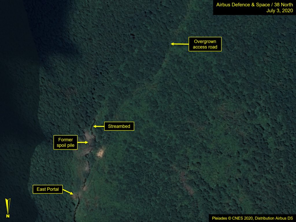
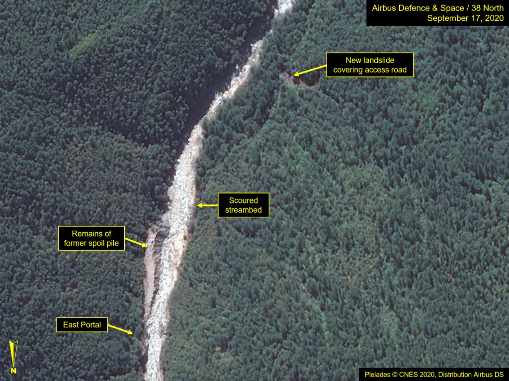
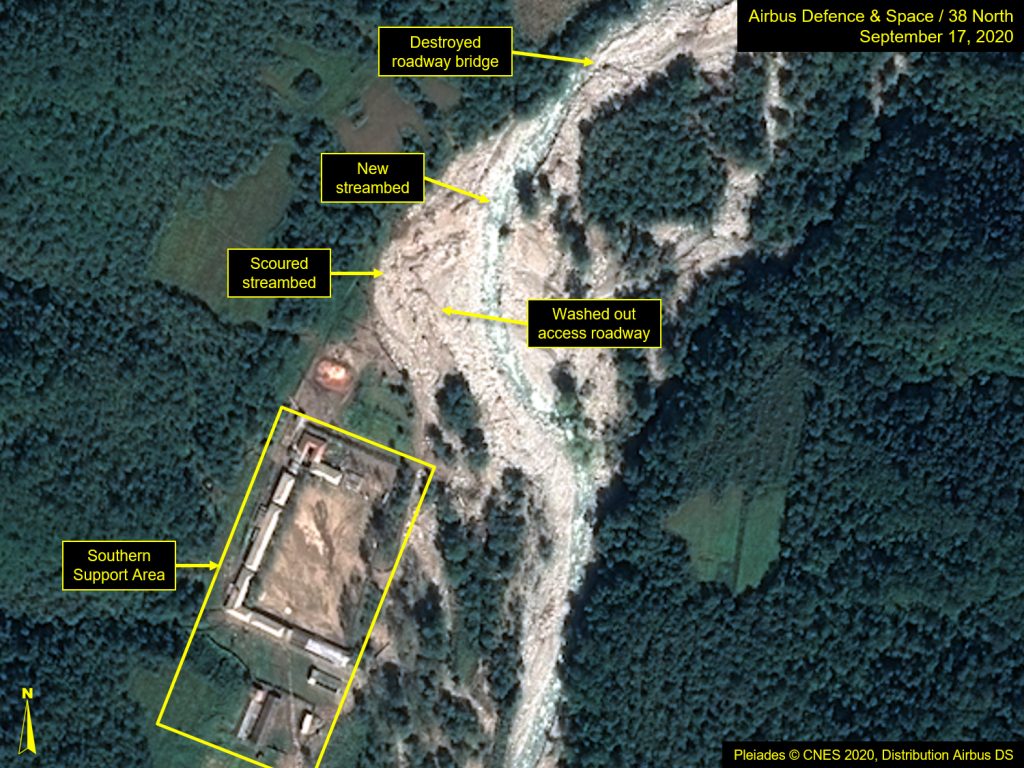
The multiple typhoons that tore through North Korea resulted in flood damage to the main road leading to the test portals, cutting off any vehicle access in to or out of the area. The footbridge, which had provided the only remaining direct personnel access to the North Portal, has also been washed out. Additionally, the access road that connects the Main Administrative Support Area with the East Portal area has been severed by a small landslide. Significantly, most of the former spoil pile adjacent to the East Portal has been largely been washed downstream as well.
Despite the damage to the surrounding roads and bridges, the buildings within the Main Administrative Support Area appear to be intact. However, it is not possible to determine whether they are currently occupied, as they appeared to be earlier this year.
There is no evidence to suggest that the flooding had any direct impact on any of the test tunnels,[1] but the damage to the main access road will require significant clean up and reconstruction before any future underground nuclear testing is viable.
Figure 2. Overview of closed portal areas.
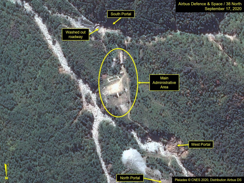
Figure 3. Landslides and scoured streambeds visible at North and West portals.
Hover over slideshow and click on left/right arrows to navigate.
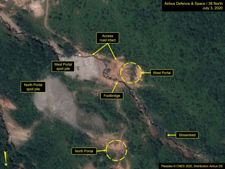
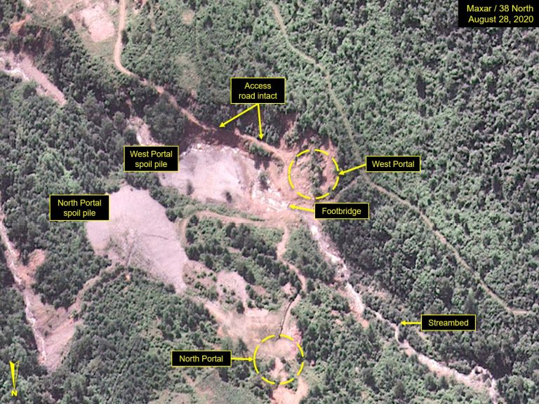
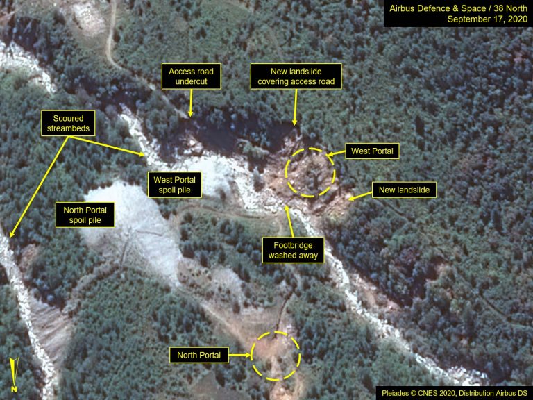
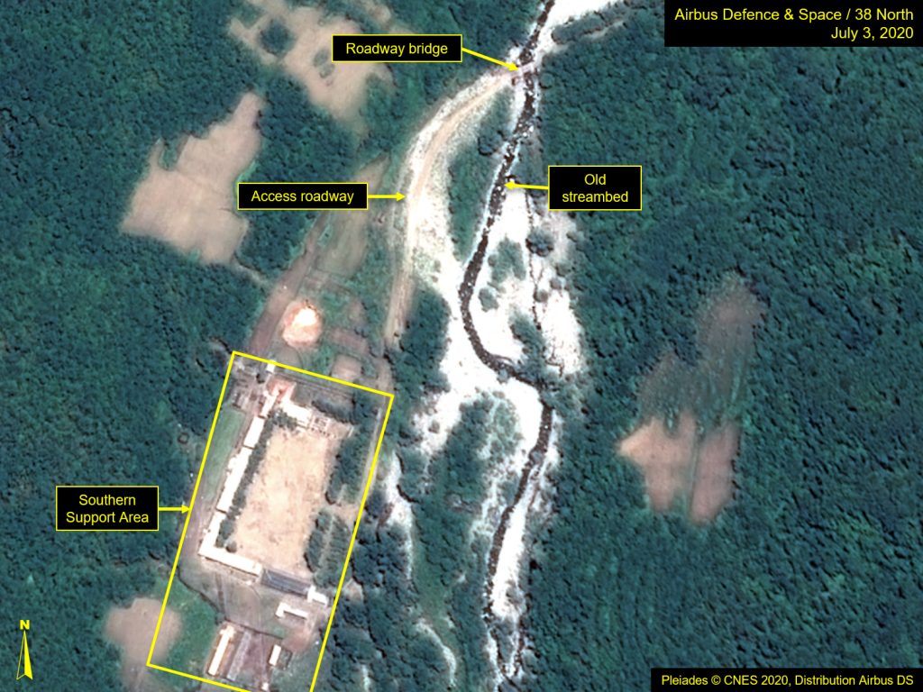
Figure 4. South Portal access road washed out.
Hover over slideshow and click on left/right arrows to navigate.
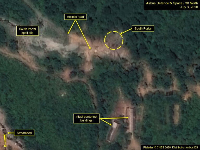
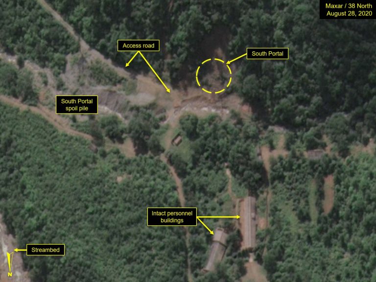
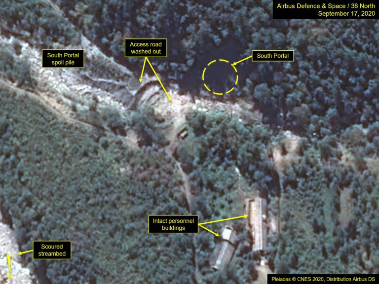
Figure 5. Landslide visible at East Portal.
Images Pleiades © CNES 2020, Distribution Airbus DS. For media options, please contact [email protected].
Command Center and Security Barracks
The Command Center and security barracks appear to be undamaged, although recent erosion and the washing out of significant sections of the nearby dirt roads are evidence that flooding occurred in this area. Mudflows are seen throughout the Command Center Support Area, providing evidence that it was also inundated by the storms.
Figure 6. Command Center appears undamaged.
Hover over slideshow and click on left/right arrows to navigate.
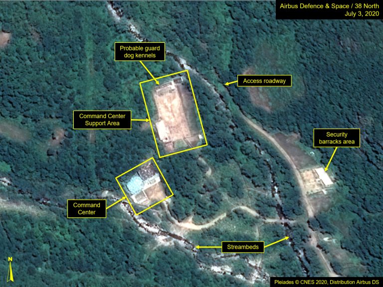
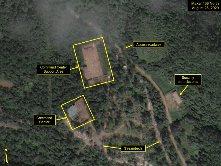
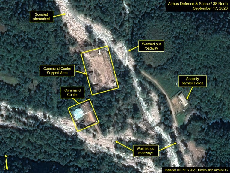
Figure 7. Mudflows visible at southern support area.
Images Pleiades © CNES 2020, Distribution Airbus DS. For media options, please contact [email protected].
- [1]
Photo and video footage showed only the tunnel entrances being demolished in May 2018. The status of the tunnels themselves remains unclear.