

At Long Last, Trucks Traverse New DPRK-Friendship Bridge
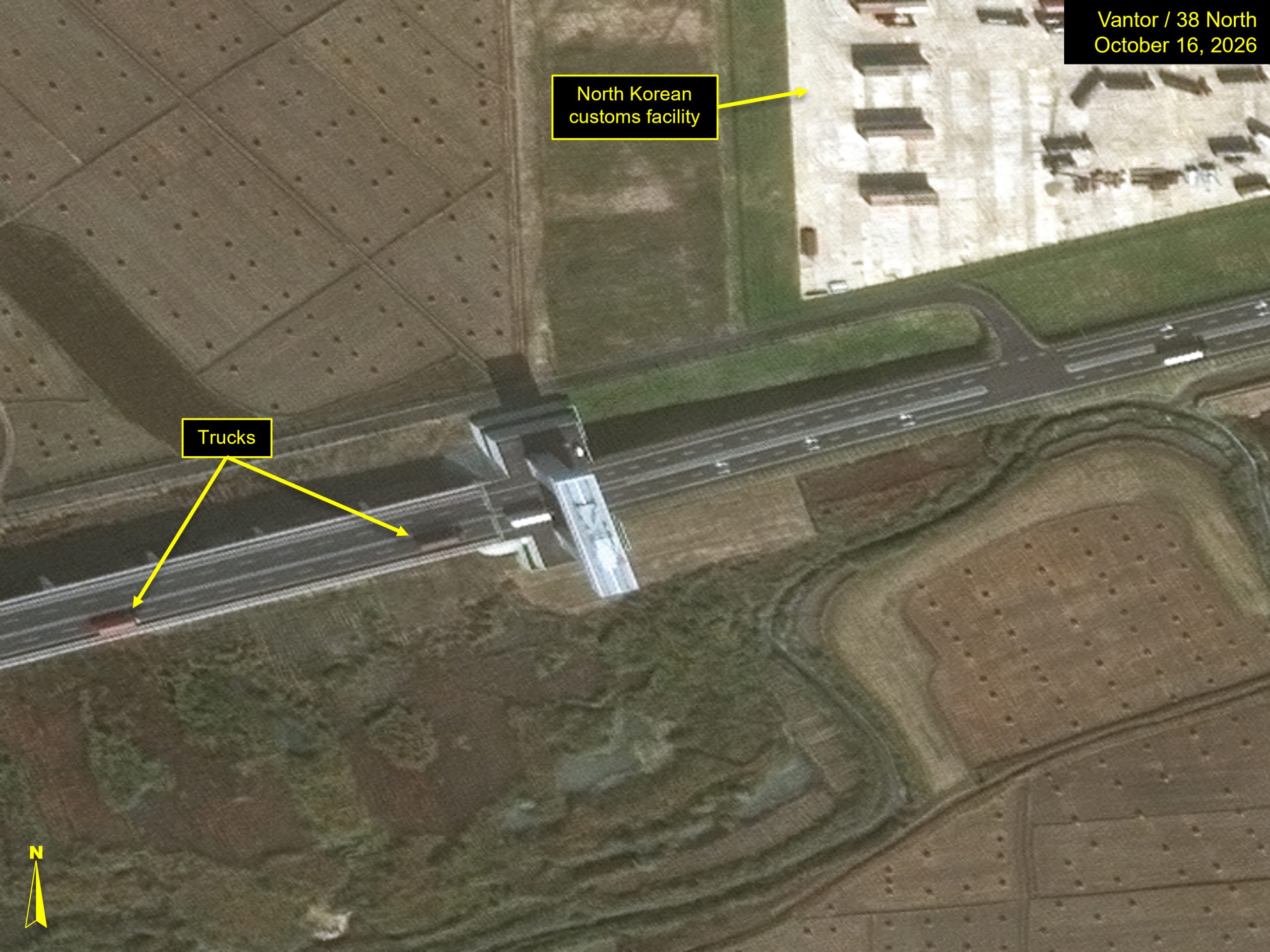
Commercial satellite imagery from October 16 indicates that a mere day after the official ribbon-cutting ceremony, significant traffic from China has begun to cross the New Yalu River Bridge.
The bridge, completed in 2014, has never officially been opened. While the Chinese side of the crossing has appeared to be complete for quite some time, work to build up facilities on the North Korean side did not begin in earnest until last year. The official opening of the crossing signifies a new, larger, primary trade path between the two countries, possibly suggesting an increase in trade activity.
Activity Around the New Yalu River Bridge
Imagery of the North Korean customs side of the border crossing from October 16 shows several cargo containers and vehicles throughout the site. Around 70 trucks appear to be loading or unloading into warehouses while a number of trucks are also parked in the northeast corner of the facility or are staged throughout the site.
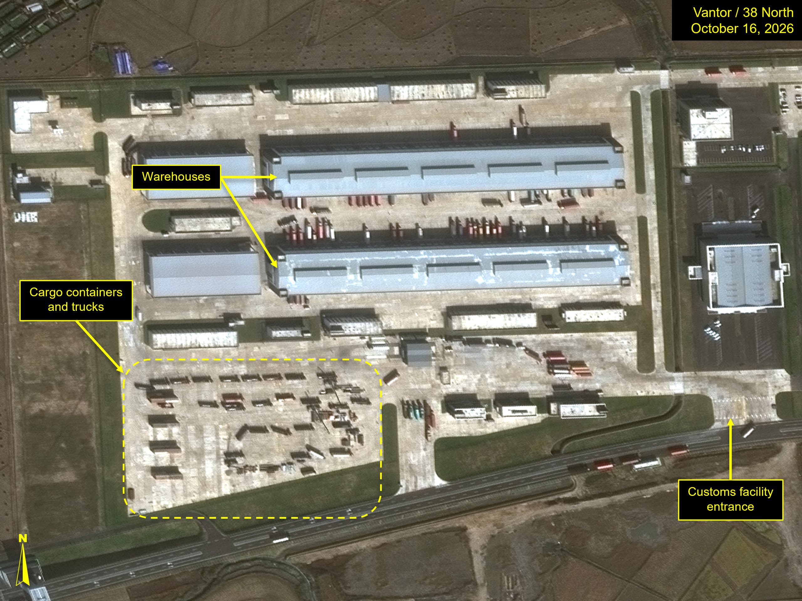
Further imagery is needed to discern the flow of trucks and cargo throughout the site. However, it appears that upon entrance, trucks from China load or unload at large warehouses located in the center of the western side of the facility. In the southwest corner, several cargo containers are observed, along with a handful of trucks. However, their position in the check-in or check-out process is unclear.
On the eastern side of the site, several trucks are parked in a lot. Further south, it appears there are two smaller warehouses with docked trucks. The purpose of these buildings is unknown. It does not appear that these vehicles utilize the same traffic flow as other Chinese trucks entering and exiting the site.
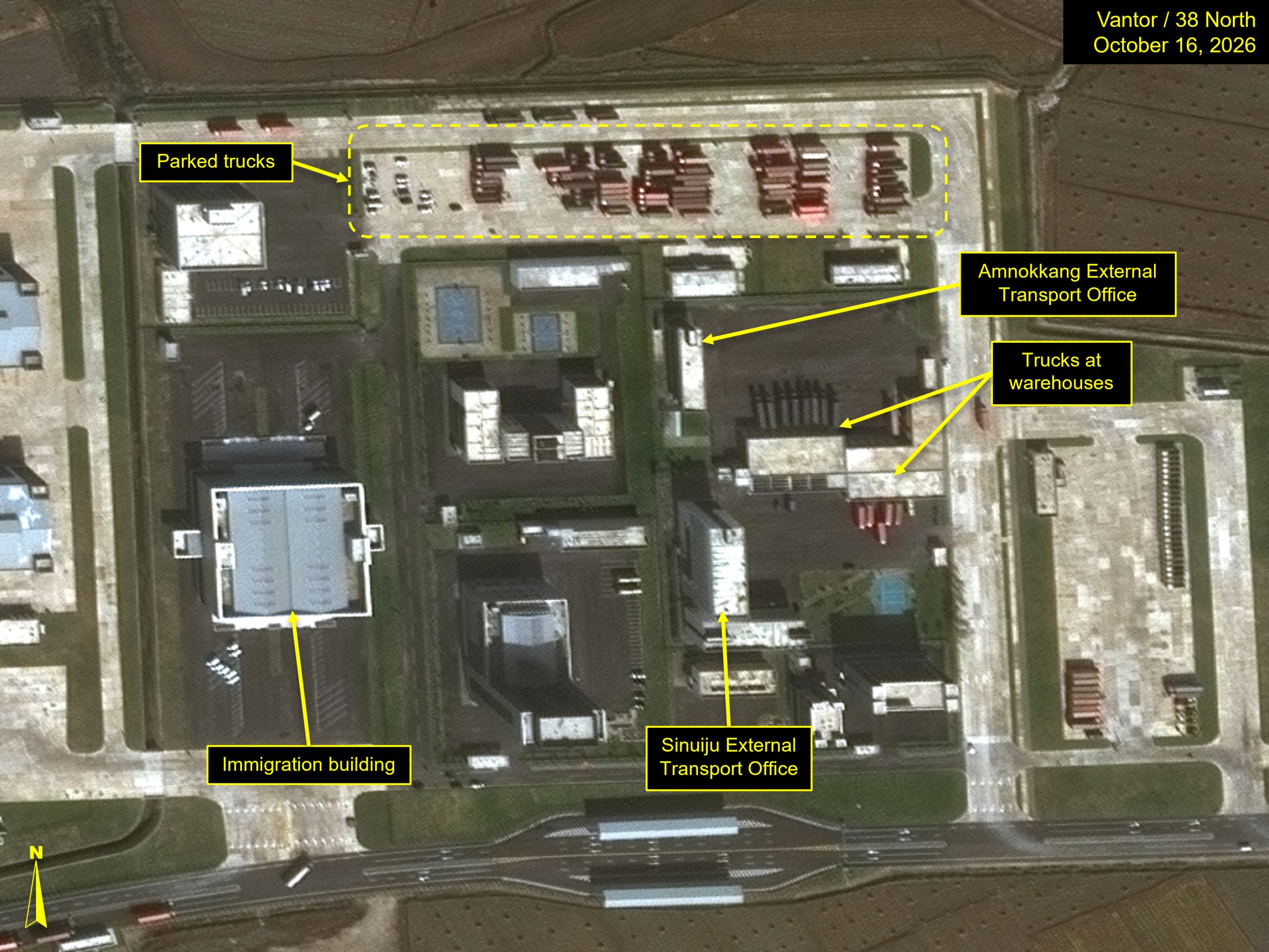
A handful of trucks were captured entering the North Korean side from China on imagery from October 16.
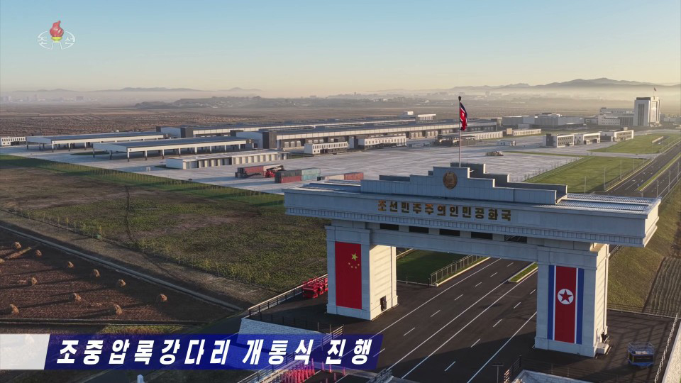
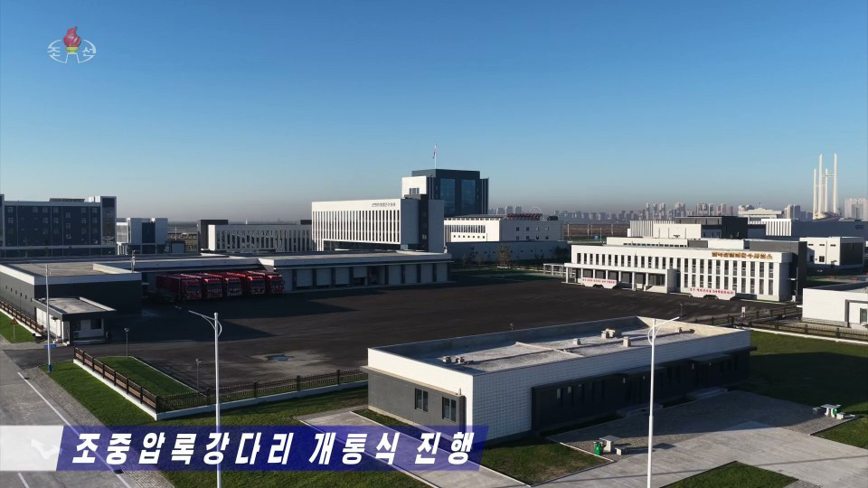
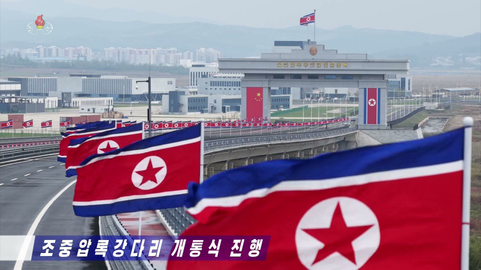
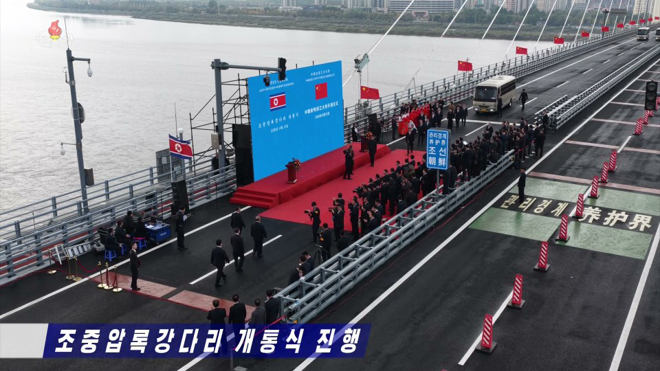
After construction appeared complete in early September, North Korean state media reported that a ribbon cutting took place at the New Yalu River Bridge on October 15. Called the DPRK-China Amnok River Bridge in North Korean coverage, the article noted that the bridge reflects “the invincible vitality and development of the DPRK-China friendship which has persevered its nature despite the trials of history.” The four-lane bridge serves as the largest border crossing between the two countries, paving the way for increased trade.
The Chinese Side
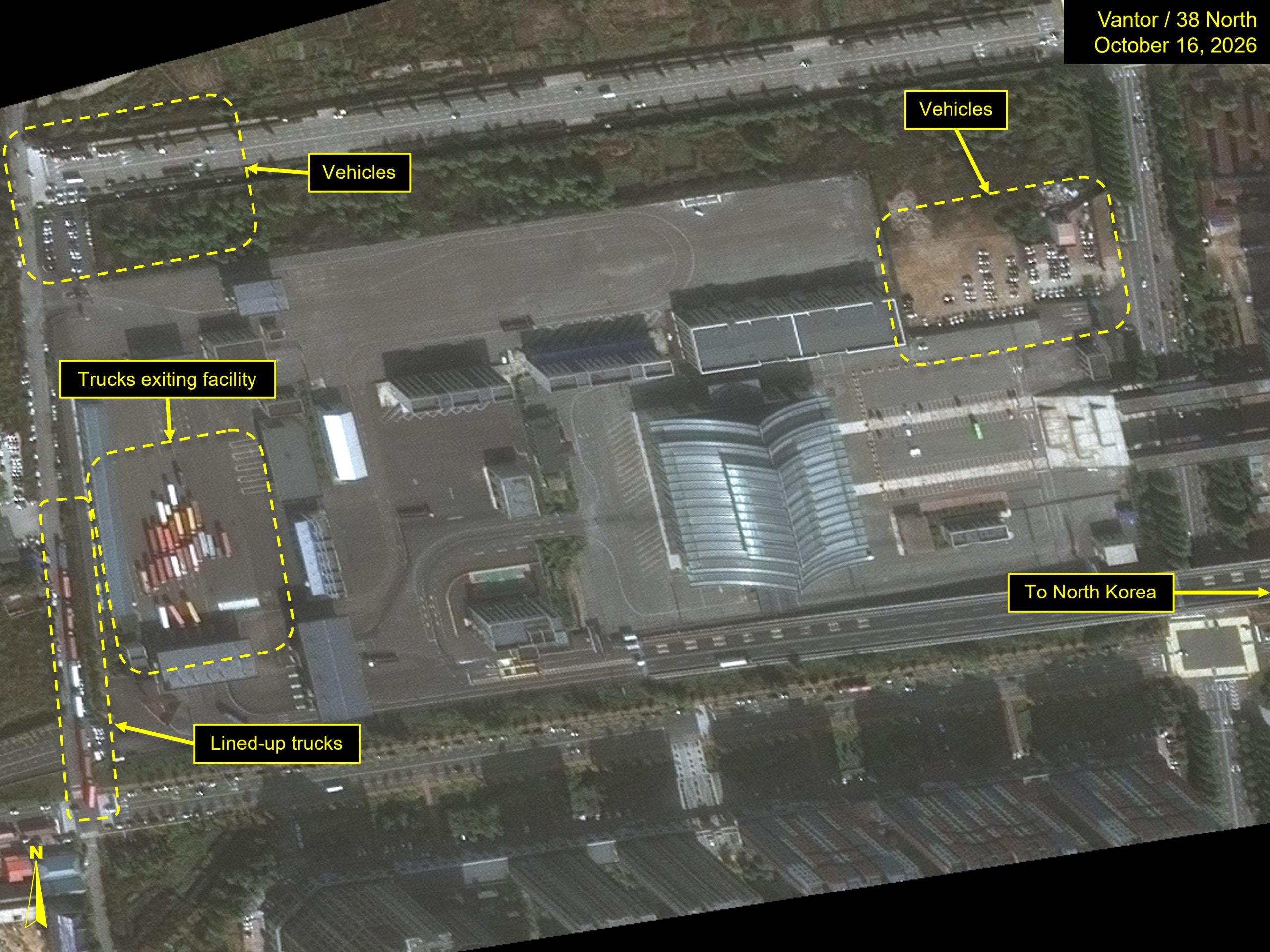
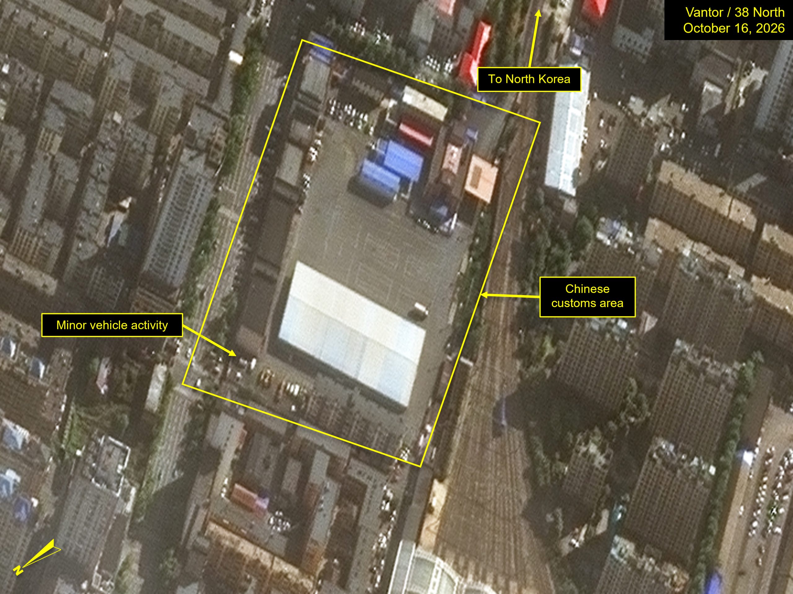
The Chinese side of the bridge, though quieter than the North Korean side, does show signs of activity. Ten trucks appear to be lined up in the street, waiting to enter the customs facility. A similar practice was used when on the old Friendship Bridge to manage traffic flow into the customs facility. Nearly 30 trucks are queuing up in the customs area waiting to cross. Throughout the site, a number of vehicles are also observed. Before the bridge opening, there were very few cars parked throughout.
Activity at the Old Friendship Bridge
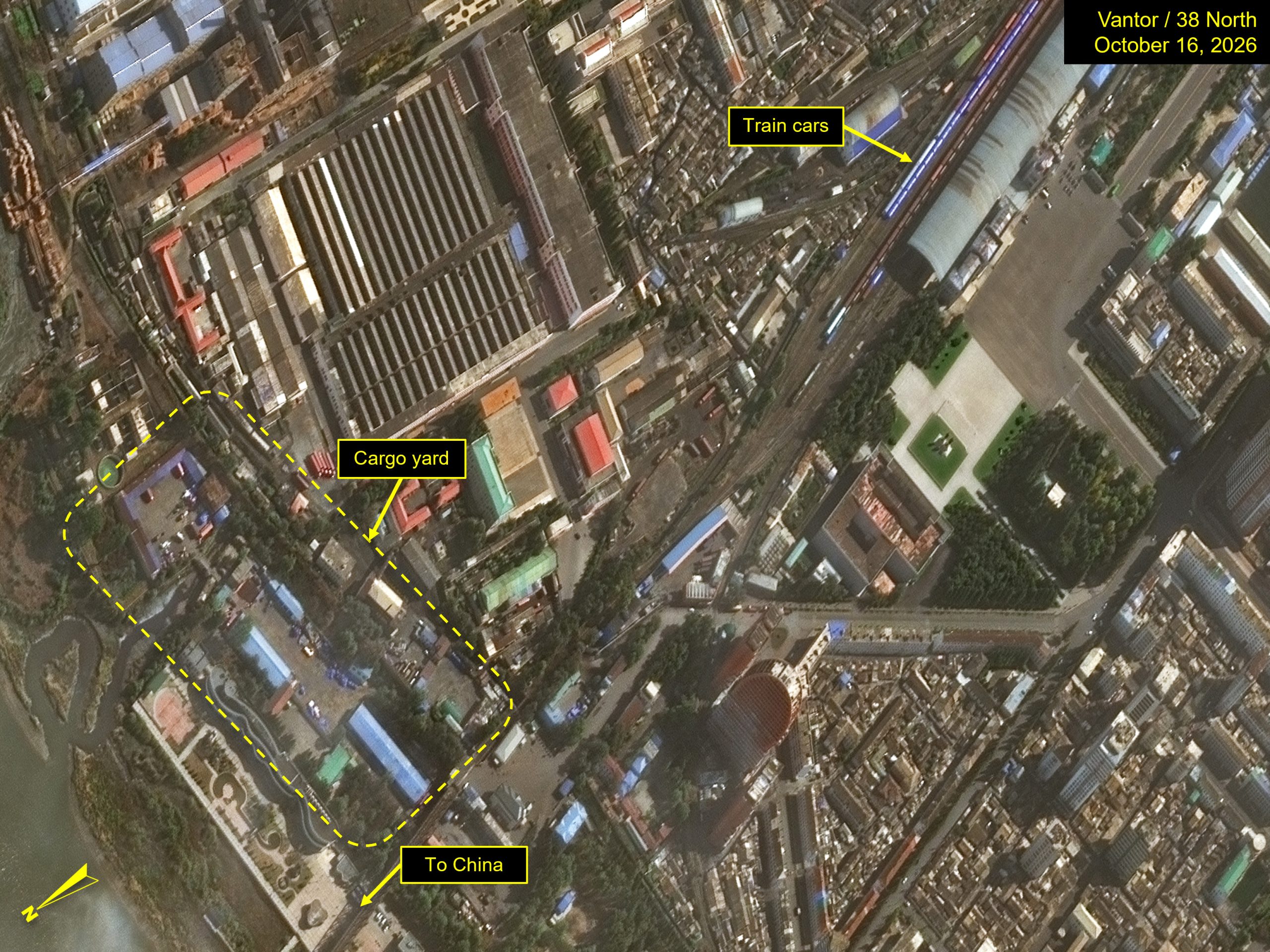
At the Sino-Korean Friendship Bridge, the previous conduit for both rail and vehicle trade between China and North Korea, little activity is observed in the truck yard on imagery from October 16. Several train cars are seen at the Sinuiju rail station, however, it is unclear if they are coming or going across the border or are simply parked at the end of the line.
It remains to be seen if both crossings will continue to facilitate trade between North Korea and China, or if the new DPRK-China Amnok River Bridge will render the original Sinuiju crossing obsolete.