

North Korea Continues Installing New Fencing
South Korean news coverage from earlier this week shows that North Korea’s fortification efforts in the border area continue. In particular, work is underway to replace a 750-meter stretch of old border fencing—one of the few remaining places where a higher security fence has not yet been installed.
North Korea continues efforts to reinforce and normalize what it now calls its southern border, fortifying defenses, deploying artillery and treating the dividing line as a permanent boundary between two hostile states. However, the Military Demarcation Line (MDL) established under the 1953 Armistice Agreement is a military separation line, not an internationally recognized border. Pyongyang’s efforts to unilaterally redefine it as a national boundary have become a growing source of political tension and controversy.
Recent Activity
On September 18, a large group of people were observed working along the fence about 3 kilometers from the Aegibong Observatory on Ganghwa Island. The workers, who appeared to be mostly North Korean citizens, were leveling an area directly adjacent to the old border fence. Images shot this week by South Korean TV station SBS show that the leveling work has been completed and installation of the new border fence is underway.
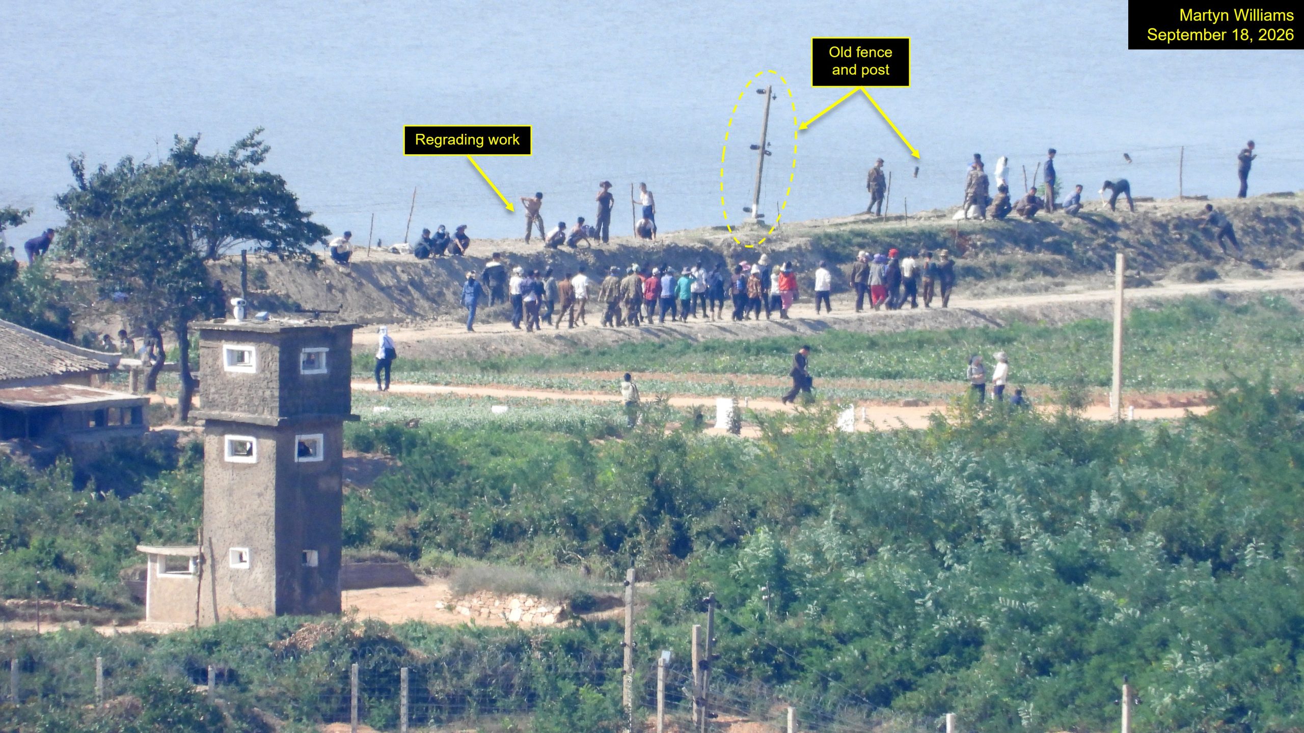
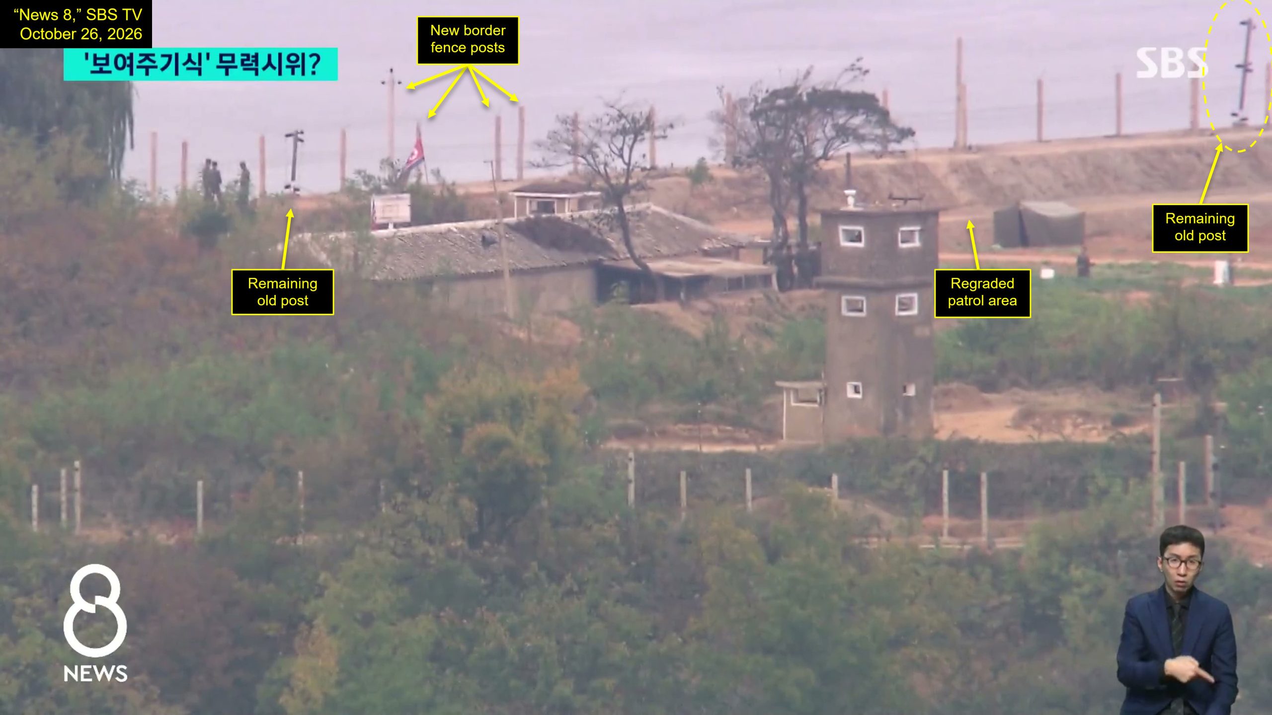
The new fence is considerably more daunting for anyone seeking to cross it. It consists of three electrified layers. A patrol road lays alongside it.
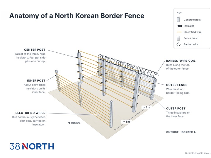
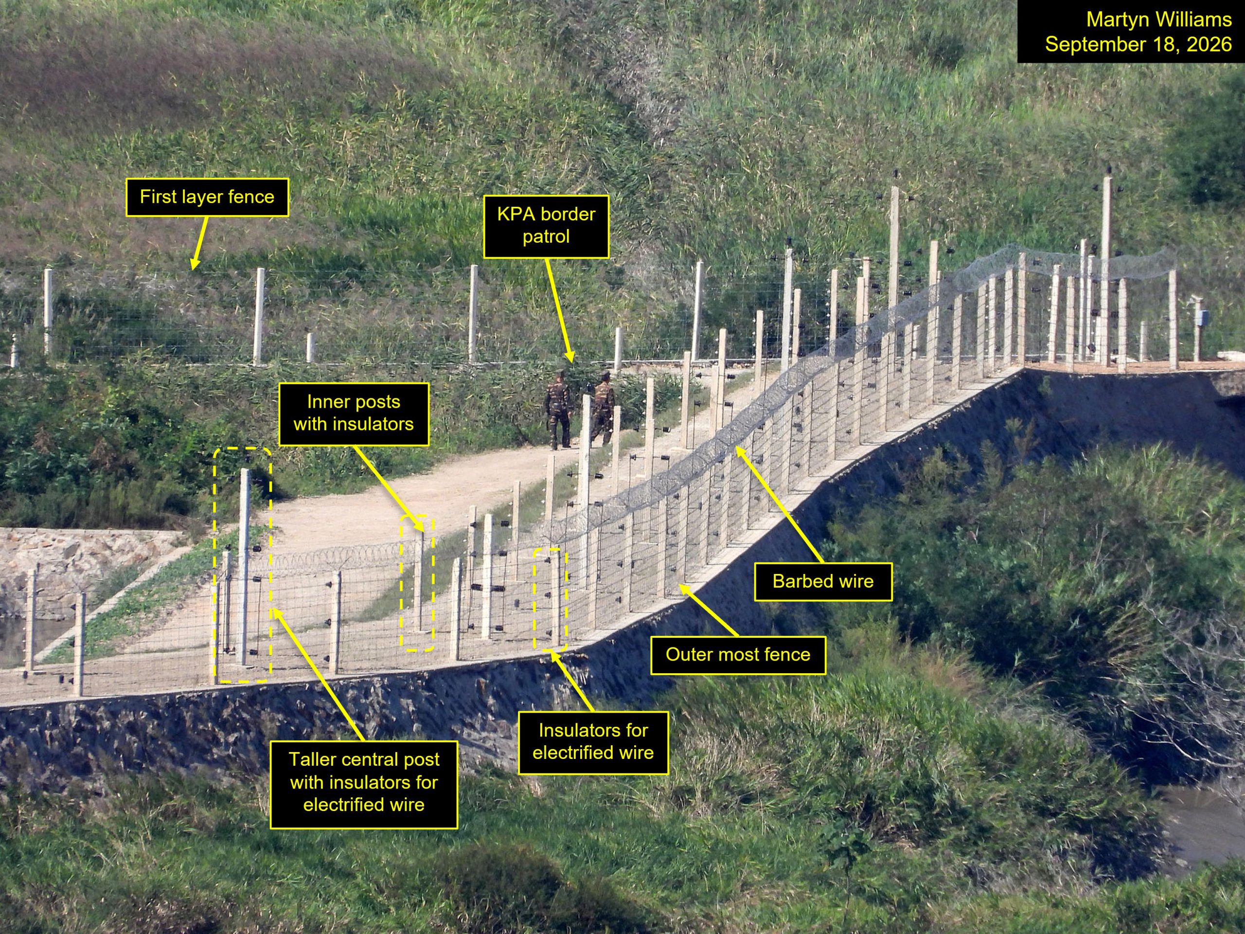
Commercial satellite imagery captured on September 17, a day before the photographs from Aegibong, also shows a large group of people working in the same area.
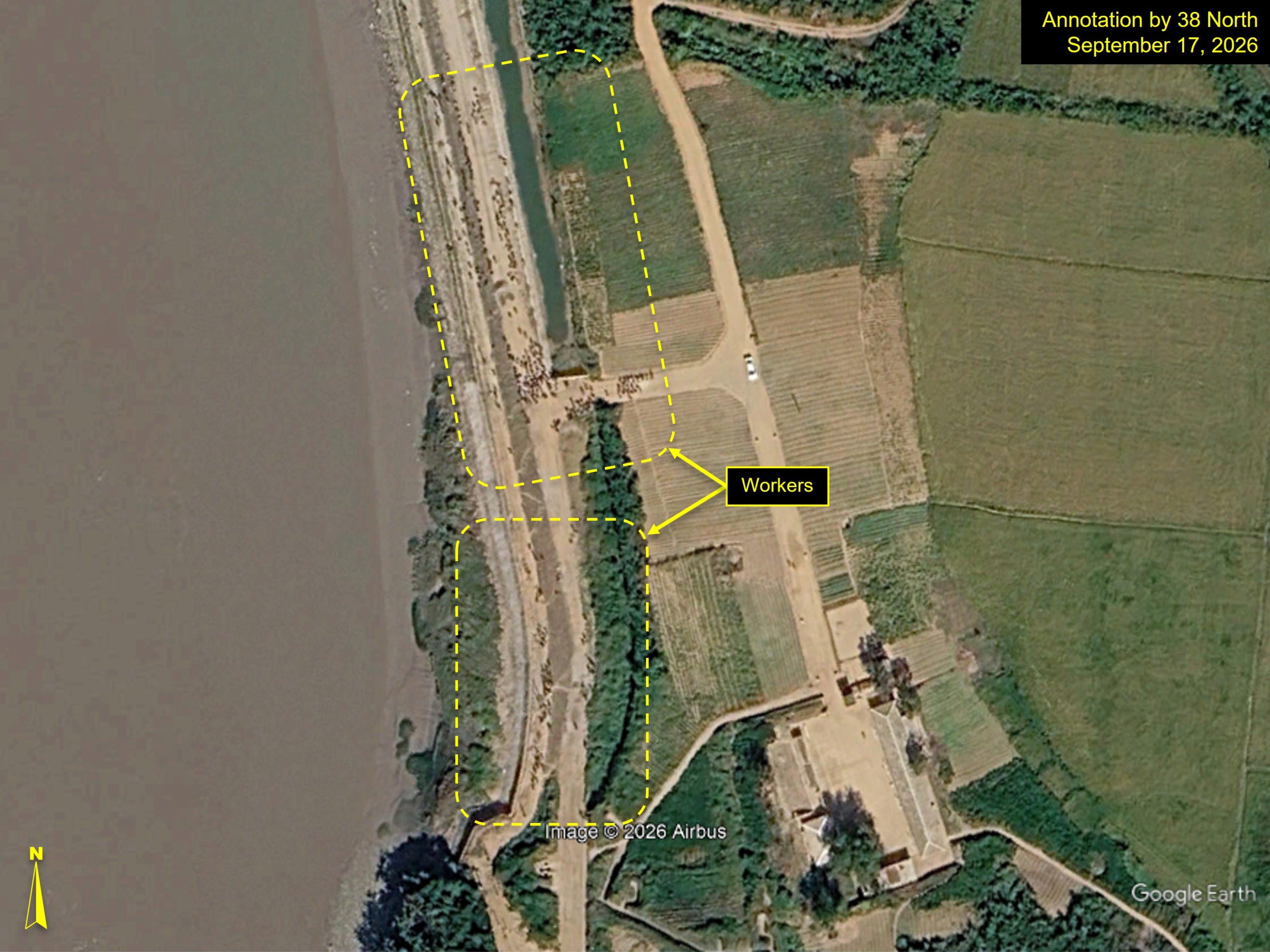
The work area sits between the ends of two sections of the new-style fencing.
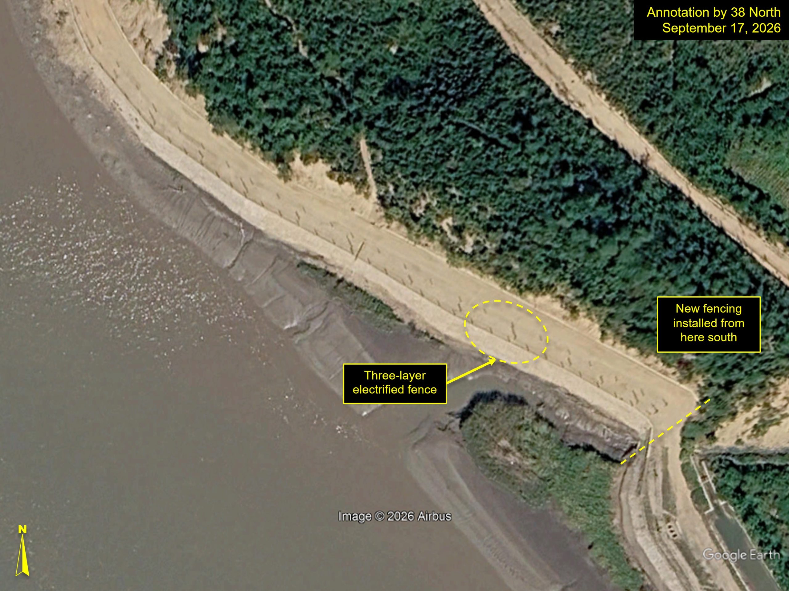
The imagery also clearly shows that three layers of fencing exist along much of the border in the area opposite Ganghwa Island.
Earlier this week, North Korean artillery appeared at several locations opposite the Aegibong Observatory. The satellite image shows preparations for the deployment of up to four artillery units had already been underway in September.
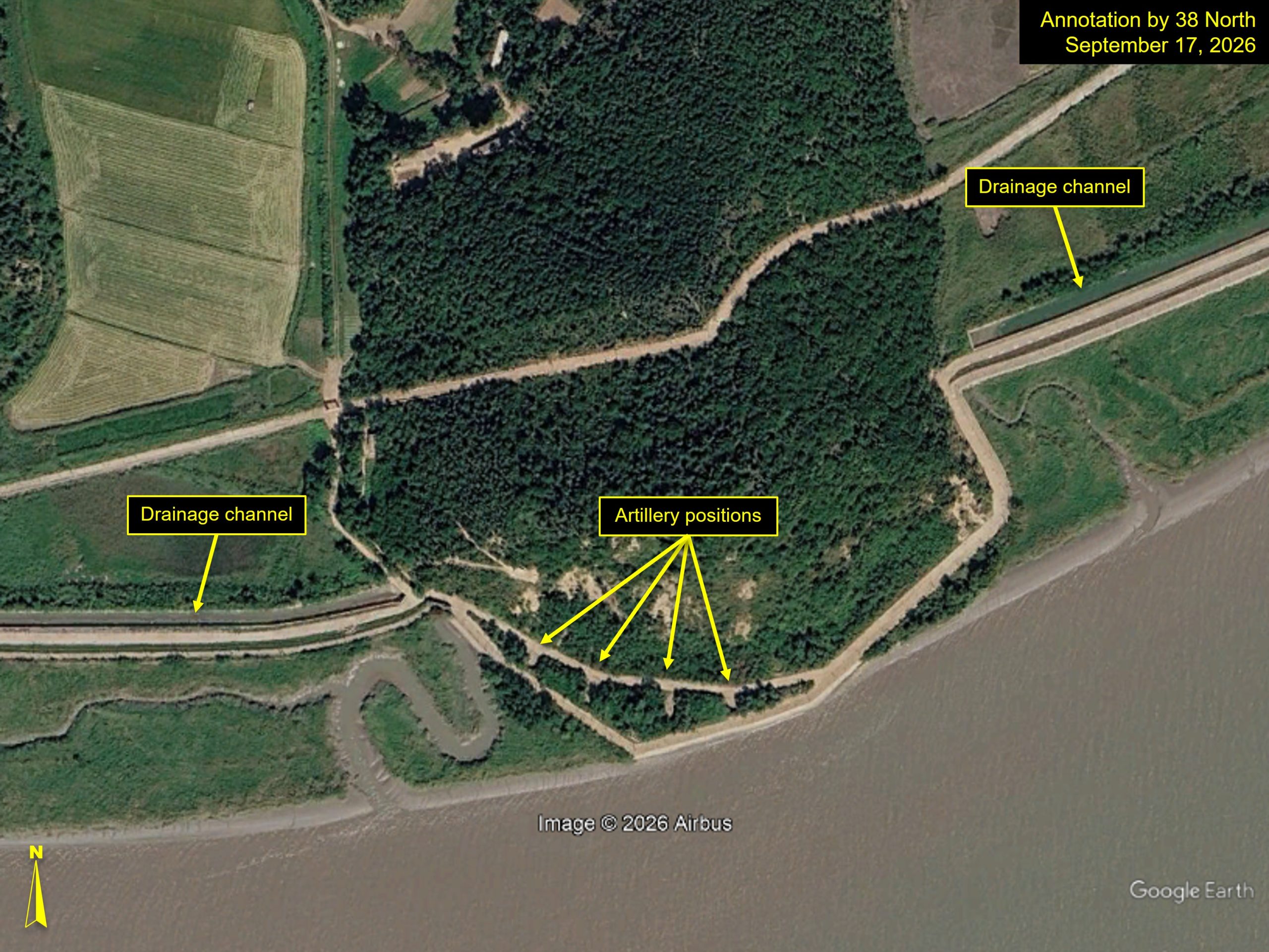
Alongside the fencing work, apparent drainage channels directly adjacent to the patrol road are also being upgraded. The channels funnel into the river at key points and could be intended to help prevent flooding in the low-lying farmland alongside the border.