

The Korean DMZ Has a Verification Problem
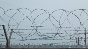
On October 5, South Korea’s military concluded that North Korean forces had deliberately planted the anti-personnel mines that injured three South Korean soldiers in the Demilitarized Zone (DMZ) two weeks earlier. North Korea rejected the finding the next day and warned that any South Korean intrusion into what it regards as its territory, even by a “millimeter,” would bring an immediate response. On October 8, the dispute reached the UN General Assembly’s First Committee, where the two Koreas again traded accusations over the incident.
The argument has moved from a minefield in the western DMZ to an international forum, but the underlying difficulty remains on the ground. North Korea is building fences, laying mines, clearing terrain, and constructing roads near the Military Demarcation Line (MDL) as part of what it considers a larger effort to fortify its “southern border.” This characterization of the MDL raises serious questions about the future of the Armistice regime in ways that are unlikely to be resolved any time soon. But the activity also highlights a more urgent need. While South Korean officials say North Korean troops have repeatedly crossed the line during this work, it has also acknowledged not all operational representations of the MDL do not fully coincide, and most of the physical markers installed after the 1953 armistice are no longer readily identifiable. As an interim measure, the parties should consider a limited joint-verification mechanism in which South Korea, North Korea, and the United Nations Command (UNC) can compare their MDL references, address discrepancies, and manage activities near the line to help reduce the risk of disagreements leading to military incidents.
The MDL Was Never Just a Line on a Map
The Military Demarcation Line was established by the 1953 Korean Armistice Agreement and depicted on nine maps at a scale of 1:50,000. The opposing sides subsequently installed 1,292 numbered markers along the roughly 250-kilometer line. The armistice required the line to be plainly marked and placed marker installation under the supervision of the Military Armistice Commission (Armistice). This arrangement linked the cartographic representation of the line to objects on the ground and to an institution responsible for implementation.
A line on a map does not automatically provide the precision required for military operations. At 1:50,000, a 0.20-millimeter line represents 10 meters on the ground; a traditional plotting tolerance of 0.64 millimeters corresponds to 32 meters. These figures do not measure the width or error of the MDL. They show why maps require physical reference points and agreed procedures before soldiers can use them to decide where to patrol, build, or clear mines.
Seven decades of physical change have weakened that system. Only a small fraction of the original markers can now be readily identified. South Korea and the United Nations Command have also developed operational reference lines from different combinations of armistice maps, surviving markers, surveys, and later geospatial data. The Defense Ministry has acknowledged discrepancies across a substantial share of the points compared.
The MDL itself has not disappeared. The difficulty is translating a legally authoritative line into a common operational reference when physical markers are sparse and the organizations responsible for security in the DMZ use different geospatial representations.
How the Verification System Eroded
The larger change has been institutional. The Military Armistice Commission was created to supervise implementation of the armistice and address alleged violations. Its role began to erode sharply in 1991, when the United Nations Command appointed South Korean Maj. Gen. Hwang Won-tak as the senior member of its commission delegation.
North Korea rejected the appointment, arguing that South Korea was not a signatory to the armistice, and stopped participating in commission plenary meetings and senior-level communications. The break deepened in 1994 when Pyongyang withdrew its remaining commission representatives and staff and ceased recognizing the United Nations Command Military Armistice Commission as its counterpart. The Armistice survived, but the institutional framework for reconciling its physical and cartographic references weakened.
Better positioning technology cannot replace that framework. GPS can locate a soldier with great precision, but it cannot determine which inherited boundary dataset the parties accept as authoritative. If forces begin with different reference lines, greater positional accuracy may simply locate their disagreement more precisely. Boundary management therefore depends on procedures for comparing references and handling discrepancies as well as on geospatial technology.
Fortification Has Made the Institutional Gap Dangerous
North Korea’s border-hardening campaign has changed the operational setting. Since Kim Jong Un redefined inter-Korean relations as relations between “two states hostile to each other,” Pyongyang has destroyed portions of inter-Korean roads and railways and expanded fortification work inside the northern half of the DMZ. Mines, fences, barriers, and new roads have repeatedly brought troops close to the MDL.
Physical separation makes the line more consequential. South Korean officials have described cases in which North Korean troops changed work locations after warnings or returned with maps and binoculars. Pyongyang insists that its forces have not crossed what it regards as the border. Such episodes do not show that every crossing results from cartographic disagreement, but they reveal how construction close to the line can turn differing operational references into military risk.
The September 21 mine explosions are a separate question of responsibility: South Korea and the UNCconcluded that the mines were deliberately emplaced south of the MDL, while North Korea denies responsibility. Cartographic uncertainty should not discount evidence of the incident. The broader verification problem matters because warnings, mine clearance, construction, and responses to suspected crossings become more dangerous when the militaries involved cannot compare the references they use.
The UNC has noted that North Korean fencing, road construction, vegetation clearing, and defensive mine emplacement are not in themselves armistice violations if they remain on the permitted side of the MDL and comply with armistice restrictions. Day-to-day enforcement therefore depends on identifying the line in practice.
Alignment Is Not Verification
Seoul has started to address part of the problem. After repeated crossings during North Korean fortification work, it proposed military talks in November 2025. Following the September 2026 mine explosions, senior officials called for clarification of the MDL and renewed dialogue. The Defense Ministry also disclosed that the Joint Chiefs of Staff and the United Nations Command formed a task force earlier this year to compare and align their MDL standards.
A common ROK-UNC operational reference would reduce ambiguity among forces on the southern side of the DMZ. It cannot, however, restore the verification function once provided by the armistice system. North Korea is not part of the task force and has rejected recent South Korean overtures. From Pyongyang’s perspective, a coordinate set shared by Seoul and the UNC is still a reference produced without its participation.
This is the difference between alignment and verification. Alignment can reconcile allied datasets. Verification requires opposing parties to compare evidence, inspect surviving markers where feasible, record unresolved discrepancies, and communicate before disagreement becomes an armed incident. The recent UN exchange shows the gap: the parties can internationalize competing claims about responsibility, but they lack a regular mechanism for managing disagreements over the line itself.
Restoring a Verification Function
The near-term practical goal of engagement on this issue should be to create a limited capacity for boundary verification, not a comprehensive settlement of the inter-Korean border. A return to the Military Armistice Commission, or an equivalent mechanism accepted by the relevant parties, could begin in sectors where construction, patrols, or mine activity creates the greatest risk. The parties could compare armistice maps with contemporary geospatial data, inspect surviving markers where possible, identify divergent operational references, and establish procedures for warnings, patrols, construction, and mine clearance.
Starting sector by sector would keep a risk-reduction measure from becoming a negotiation over the political status of the entire boundary. Unresolved points could be recorded rather than forced into immediate settlement, while areas of agreement could inform common operating procedures.
One procedural dispute also deserves reconsideration. A South Korean general continues to serve as the senior member on the United Nations Command side. North Korea cited the appointment of a South Korean officer when it stopped participating in formal commission meetings in 1991. The United Nations Command has maintained that the armistice imposes no nationality restrictions on commission members. Reconsidering this issue need not mean excluding South Korea from a future verification mechanism. Any workable arrangement would have to ensure meaningful South Korean participation in decisions affecting its security.
What could be negotiable is the composition of the UNC delegation, including the senior-member arrangement. Washington and Seoul could nevertheless treat the senior-member arrangement as a bargaining issue, indicating a willingness to discuss it if Pyongyang returns to the commission or accepts an equivalent joint-verification mechanism. The aim would be to remove a procedural obstacle to North Korean participation without diminishing South Korea’s substantive role in the verification process. The question is whether a procedural dispute that has obstructed formal dialogue for more than three decades can be exchanged for an institution that reduces military risk.
Getting the Parties on Board
North Korea’s border policy gives Pyongyang a reason to consider such an arrangement. A government seeking permanent separation has an interest in reducing disputed crossings of the boundary it claims to defend. Fortifications restrict movement; they do not establish a mutually understood line or provide a way to manage incidents. Finding the right mechanism to resolve this dispute should be a priority for all the parties involved.
The September mine dispute has reached the United Nations while South Korea and the United Nations Command work to reconcile their MDL references. Both developments speak to the need to rebuild the verification capacity that has eroded since the early 1990s. The armistice addressed the limits of representing a boundary on maps through physical markers and a joint institution, but many of those markers have since disappeared, and the commission ceased to function as a regular forum between the opposing sides. North Korea is now building a more rigid physical boundary on top of that weakened system.
A resurvey or a more accurate digital map would help, but operational certainty also depends on an institution able to compare references, preserve agreed records, and manage disagreements. Restoring that capacity does not require agreement on reunification, denuclearization, or a peace treaty. It requires a narrower decision to make the existing armistice boundary governable before another mine, fence, patrol, or construction project turns a manageable discrepancy into a military crisis.