North Korea’s Punggye-ri Nuclear Test Site: Three Years After Its Dismantlement
Three years ago, on May 24, 2018, in the lead-up to the first US-DPRK summit, North Korea dismantled the Punggye-ri Nuclear Test Site in a dramatic fashion, using explosives to demolish support buildings and test tunnel entrances. While international reporters were present to witness and document this event, questions remained about the permanency of these actions, given little evidence the test tunnels were destroyed past the entrances, and the Headquarters Building and Command Center were untouched.
If the tunnels are still intact, it is probable that the site could be reactivated by re-excavating the tunnel entrances and rebuilding support infrastructure—activities that would be observable in satellite imagery. However, despite the breakdown in US-DPRK negotiations, no such attempts have been observed at Punggye-ri, and there are no indications that Pyongyang plans to take these actions. Instead, over the past three years, commercial satellite imagery has indicated only limited activities throughout the site, including ongoing security foot patrols and probable radiation monitoring throughout the test tunnel area, as well as post-flooding road repairs to keep the site accessible.
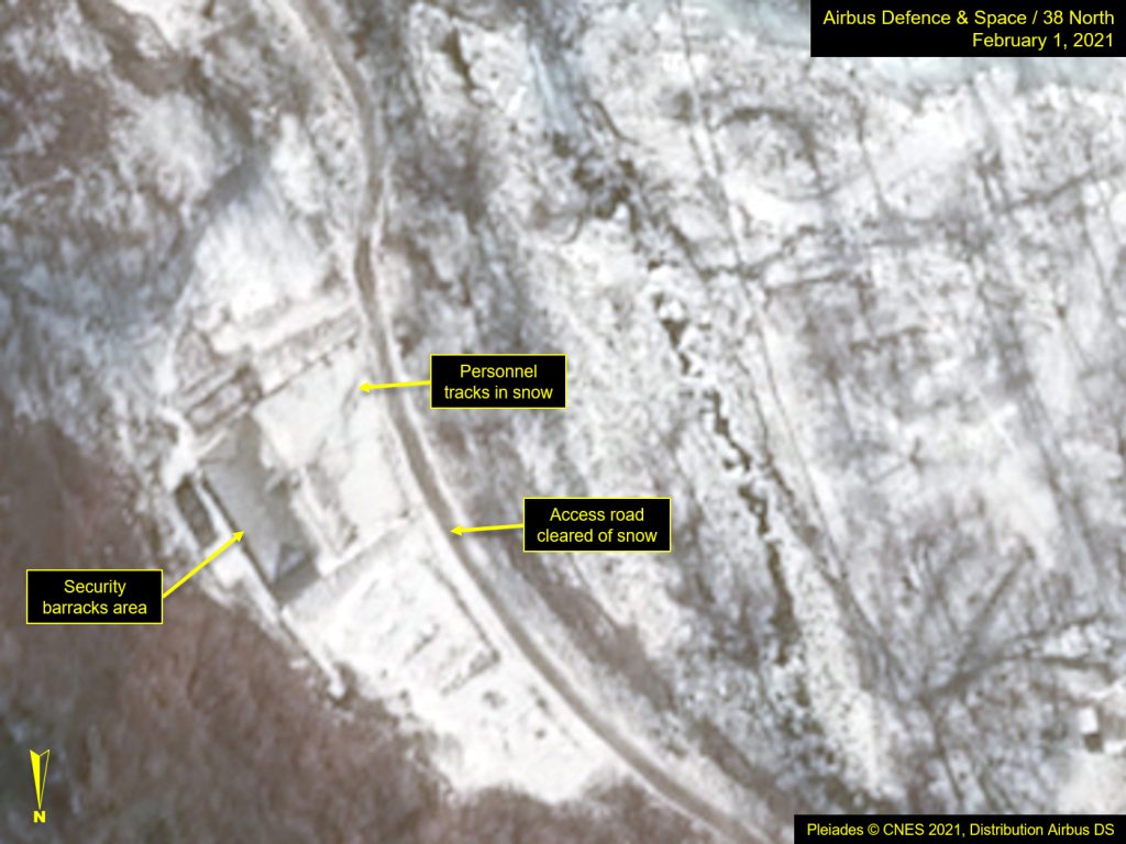
In the past six months, imagery indicates no major new activity, although there is evidence that personnel remain on-site.
Figure 1. Personnel tracks observed at Security Barracks.
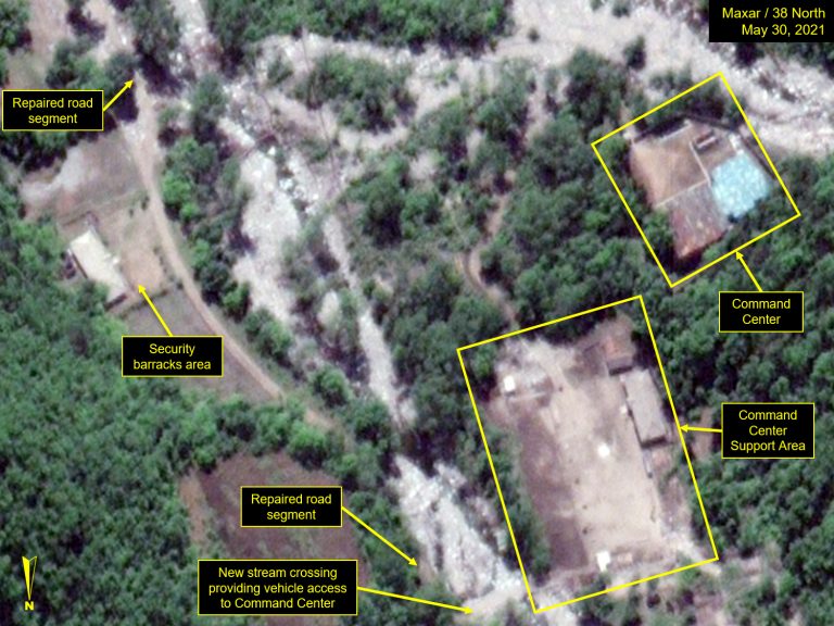
Despite significant damage to the main access road last fall, there is no indication of attempts to clear the extended stream bed of debris or prepare the area against future flooding. Instead, it appears that the roadway was rerouted to maintain access to the test tunnel area.
Figure 2. Temporary road at Southern Support Area.
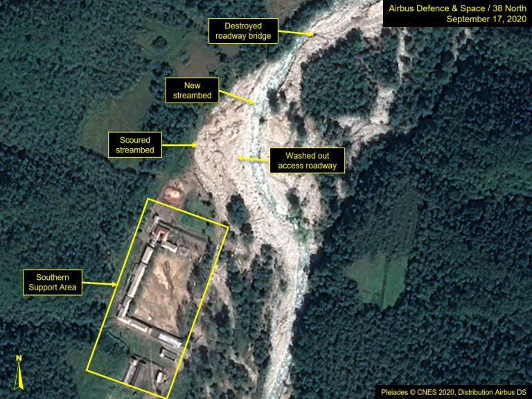
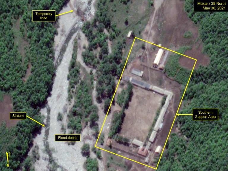
Figure 3. Road segments repaired at Southern Support Area.
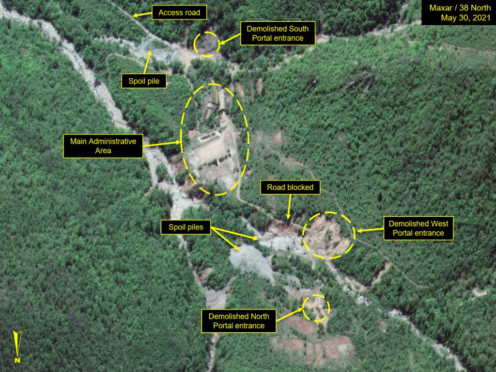
The repaired roadway provides vehicle access only up to the collapsed debris of the West Portal. Beyond that, the North Portal can only be reached by foot, as is also the case with the East Portal, the site of the first nuclear test.
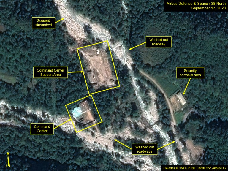
Figure 4. No major activity since tunnel entrances demolished.
Until an independent inspection team with the proper equipment and expertise is allowed on-site to assess the extent of damage to the test tunnels, the potential for reactivating the site remains if Pyongyang decides to resume nuclear weapons testing.