A Fresh Look at North Korea at Night
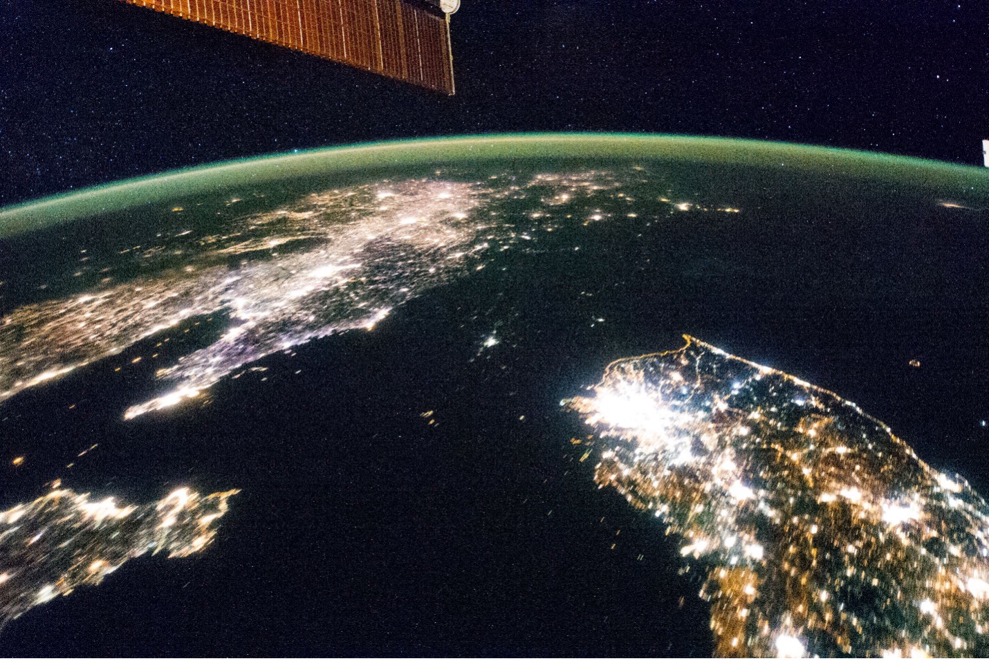
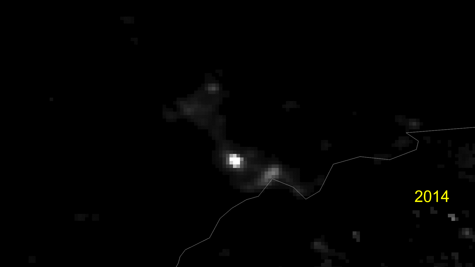
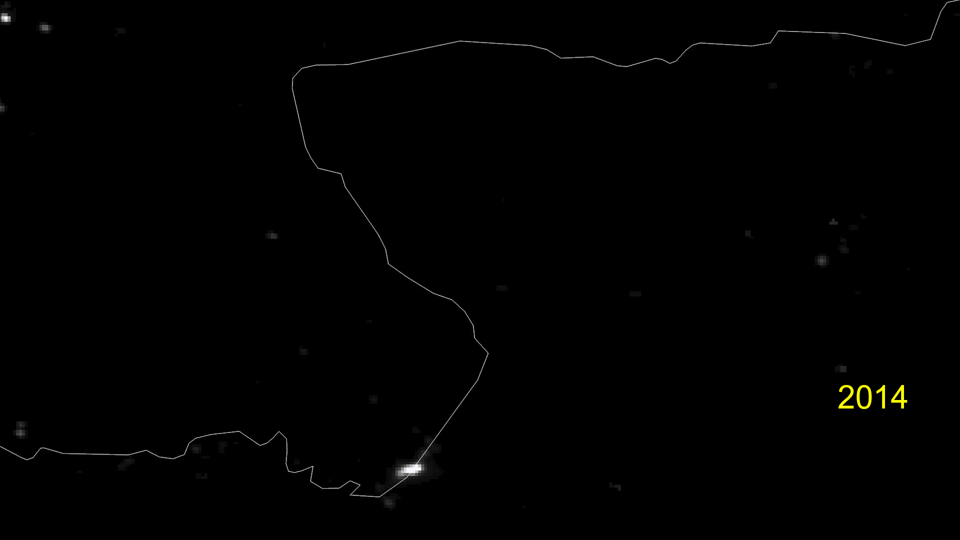
In January 2014, astronauts on board the International Space Station (ISS) took a photo that dramatically illustrated the economic divide between North Korea and its neighbors. It showed both South Korea and China bathed in nighttime light while North Korea was largely dark.
Nine years on, has anything changed?
Examination of nighttime images from the past seven years shows that North Korea is getting brighter at night, although it is still outpaced by its richer, more industrialized neighbors. The patterns of newly lit-up areas do tend to align with Kim Jong Un’s priority development projects, such as large industrial complexes and housing projects, and even active construction sites. In the Samjiyon region, for instance, entire towns that were not visible a few years ago are now faint dots in nighttime imagery.
It is a far cry from South Korea’s enormous glow, but indicates that there are areas in North Korea with more access to electricity than before.
However, despite persistent and ongoing efforts to increase energy production inside North Korea, such as the recent completion of the Orangchon Power Plant after 40 years of construction, the country continues to suffer from a chronic shortage of electricity. Even compared to other developing countries, like Myanmar, the North’s night light profile still lags far behind. Solar and renewable energies are helping fill in some gaps, but as the imagery shows, massive energy boosts are still sorely needed.
Background
The ISS image was captured as it flew about 400 kilometers (km) above the Korean Peninsula on January 30, 2014, at 10:16 p.m. Korean Standard Time. In the image, Pyongyang shines about as bright as a mid-size South Korean city, and a few other cities, such as Wonsan, Hamhung and some areas around Pyongyang, can be located as smaller specks of light. Security lights along the demilitarized zone (DMZ) clearly mark the border between the two Koreas.
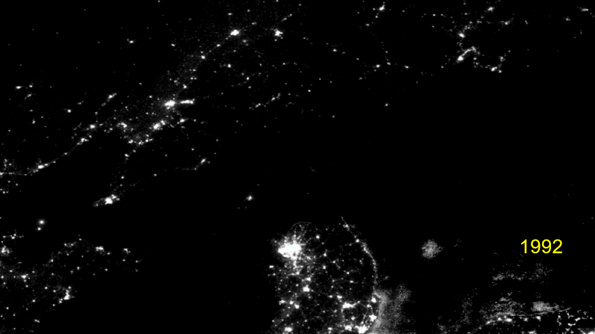
While the ISS image captured attention at the time, it was not the first capture of North Korea at night. The Defense Meteorological Satellite Program (DMSP), operated by the US Department of Defense, has been capturing nighttime images of North Korea since the 1970s.
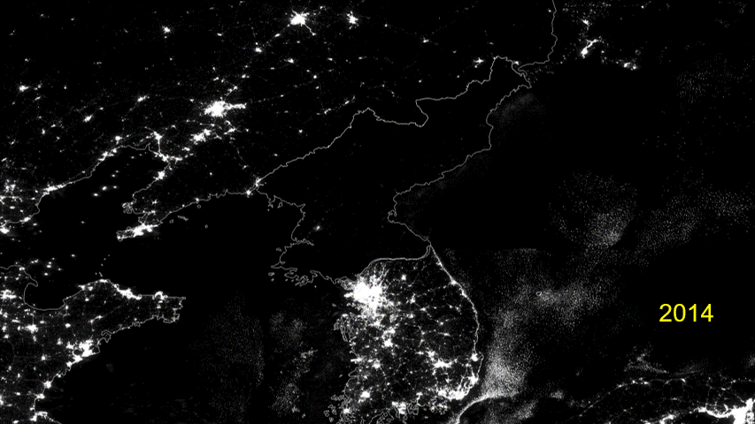
However, in 2012, the Visible Infrared Imaging Radiometer Suite (VIIRS) instrument onboard the NASA/National Oceanic and Atmospheric Association (NOAA) Suomi National Polar-orbiting Partnership (NPP) satellite began providing superior nighttime satellite imagery. The service has been supplemented with the launch of VIIRS on the NOAA-20 and NOAA-21 weather satellites, and it will be included on several additional upcoming satellites.
The two sets of images are not directly comparable because of the different satellites and sensors used, but they both tell a story of a country that remains decades behind its neighbors in industrial development.
The lights at sea on either side of the Korean Peninsula are mostly fishing boats.
About the Images
This article is based on VIIRS images gathered daily by the Suomi NPP and the NOAA-20 satellites. For this analysis, we used monthly and annual VIIRS Day/Night Band images from the Earth Observation Group (EOG) at the Colorado School of Mines. The images show the average radiance levels over the period and are processed to keep stray light and other data errors to a minimum and be cloud-free.
Each pixel on the Day/Night Band image is approximately 375 meters square. This means the data can be used to determine radiance to a moderate resolution but cannot differentiate between individual buildings.
Pyongyang
North Korea’s capital city has gotten visibly brighter throughout Kim Jong Un’s rule. Under Kim, a number of new construction and development projects have taken place that include a generous use of external architectural lighting. Buildings throughout the capital are externally lit at night, in addition to statues of Kim Il Sung and Kim Jong Il.
One of the biggest changes to the city has been Kim’s project to build 50,000 apartments in Pyongyang between 2021 and 2026.
The massive construction sites for these projects are illuminated brightly during the night, and after completion, lights from the tower blocks create a new, permanent source of nighttime light. In this image from August 2022, bright light is visible from construction at the Hwasong area project and also from the Sadong area project that opened earlier in 2022.
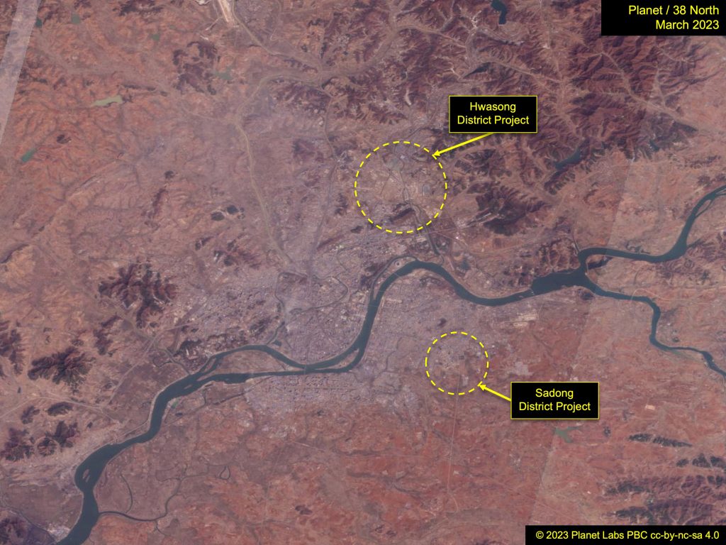
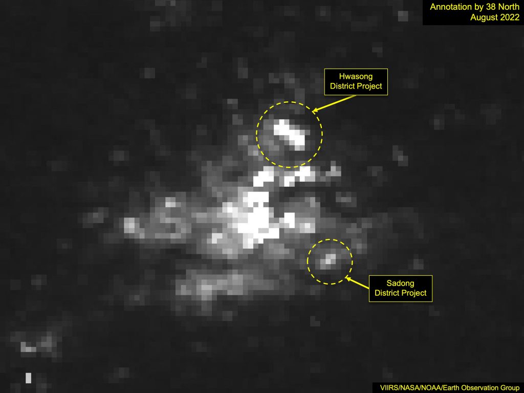
Figure 5a. The Sadong and Hwasong areas of Pyongyang are visible in this image from March 2023. Image © 2023 Planet Labs, PBC cc-by-nc-sa 4.0. Figure 5b. The Sadong and Hwasong areas of Pyongyang are visible in this image from August 2022. Photo: VIIRS/NASA/NOAA/Earth Observation Group. Annotation by 38 North. For media licensing options, please contact [email protected].
Several areas close to Pyongyang are also evident, including the Chollima Steel Mill (Complex), Sangwon Cement Complex and Taean Heavy Machinery Complex.
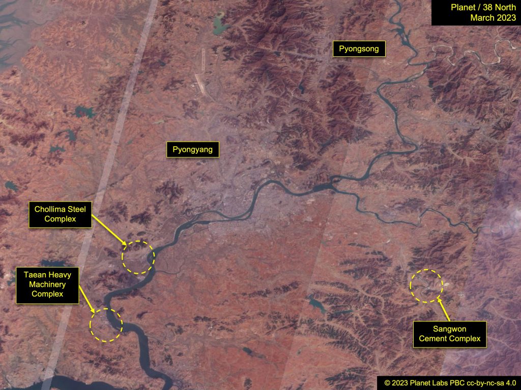
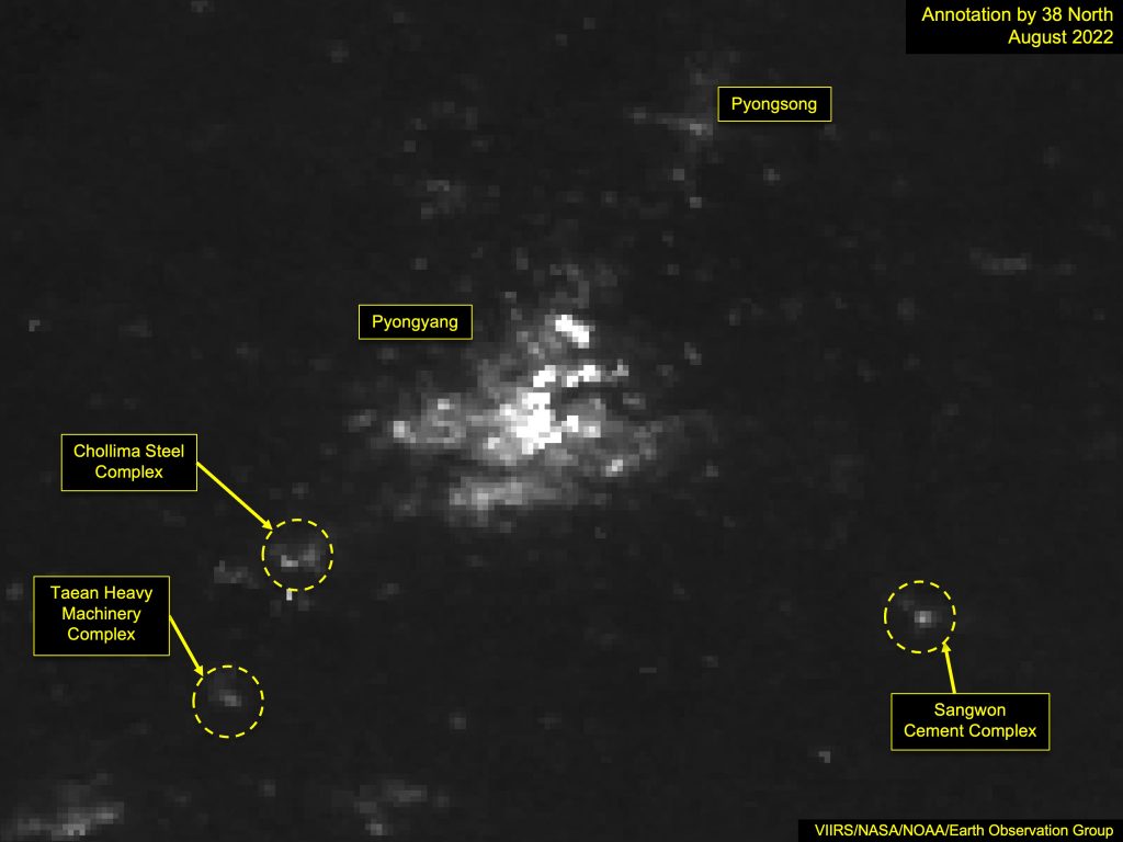
Figure 6a. Industrial establishments in the greater Pyongyang area. Image © 2023 Planet Labs, PBC cc-by-nc-sa 4.0. For media licensing options, please contact [email protected]. Figure 6b. Industrial establishments in the greater Pyongyang area. Photo: VIIRS/NASA/NOAA/Earth Observation Group. Annotation by 38 North.
Hamhung
North Korea operates a dual electricity grid that often results in factories and the military getting power while households do not. At night, this can mean that major factories shine more brightly thanks to the greater supply of electricity than their neighboring towns. A good example of this can be seen in Hamhung.
The industrial area of the city around Haean-guyok is consistently brighter at night than the downtown area.
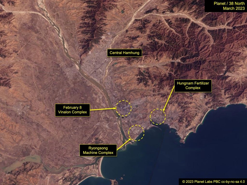
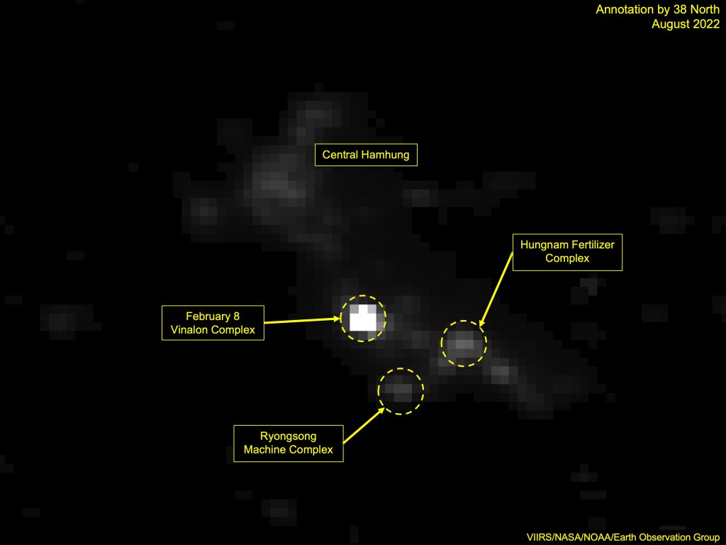
Figure 7a. Industrial establishments and the central Hamhung area. Image © 2023 Planet Labs, PBC cc-by-nc-sa 4.0. For media licensing options, please contact [email protected]. Figure 7b. Industrial establishments and the central Hamhung area. Photo: VIIRS/NASA/NOAA/Earth Observation Group. Annotation by 38 North.
The brightest area is the February 8 Vinalon Complex, which occupies around 2.5 square km and is one of the largest industrial establishments in the area. Also visible as sources of light are the Ryongsong Machine Complex and Hamhung Fertilizer Complex.
Nampho
In the port city of Nampho, the brightest lights in 2021 were those at the container port. Despite Covid restrictions that shuttered most foreign trade, the Nampho container port appeared busy throughout 2021 in daytime imagery, which is also mirrored in the nighttime coverage.
The area around the coal port was also bright in the latest image. The nearby Ryongnam shipyard is also lit, although noticeably dimmer.
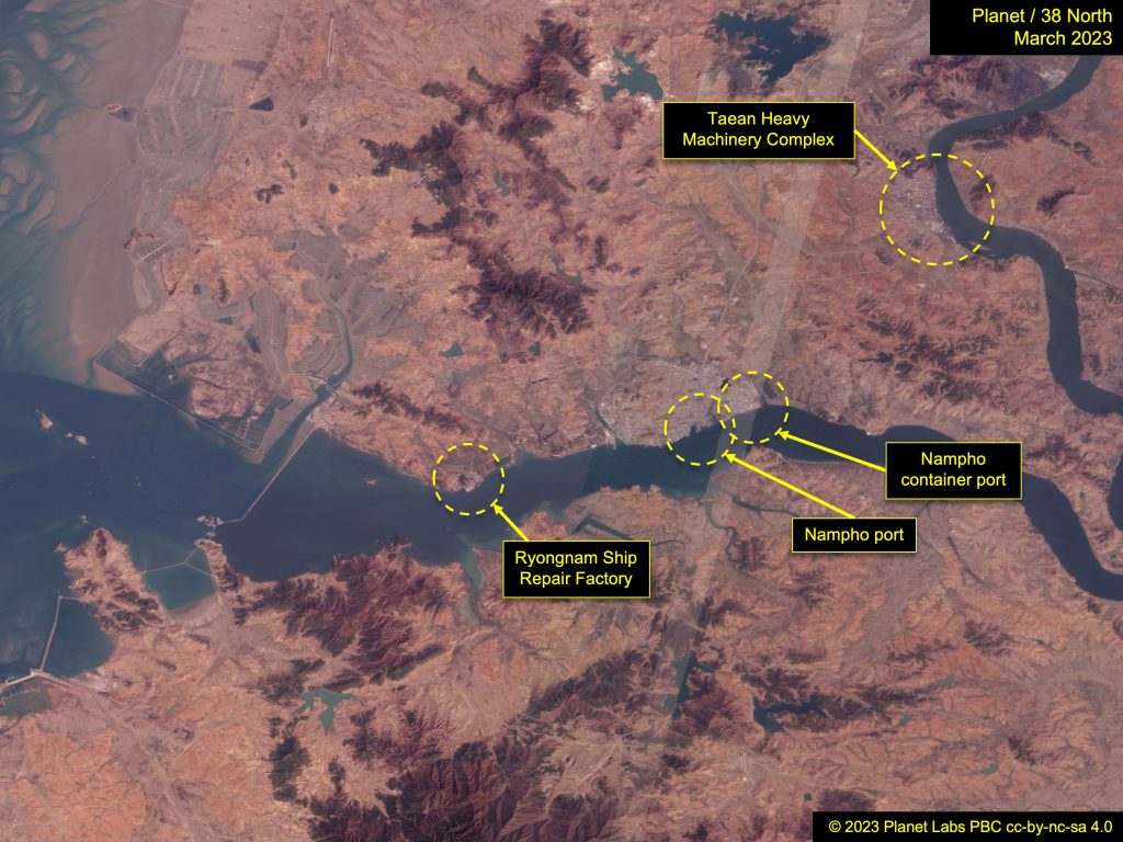
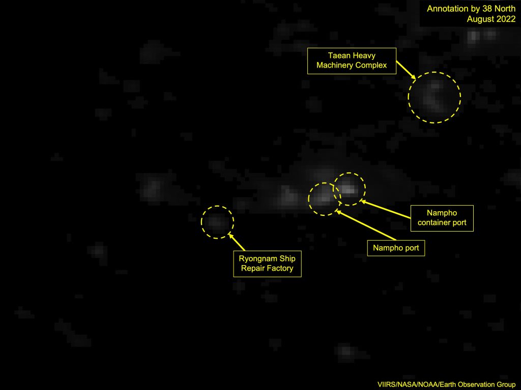
Figure 9a. Nightlights in the Nampho area. Image © 2023 Planet Labs, PBC cc-by-nc-sa 4.0. For media licensing options, please contact [email protected]. Figure 9b. Nightlights in the Nampho area. Photo: VIIRS/NASA/NOAA/Earth Observation Group. Annotation by 38 North.
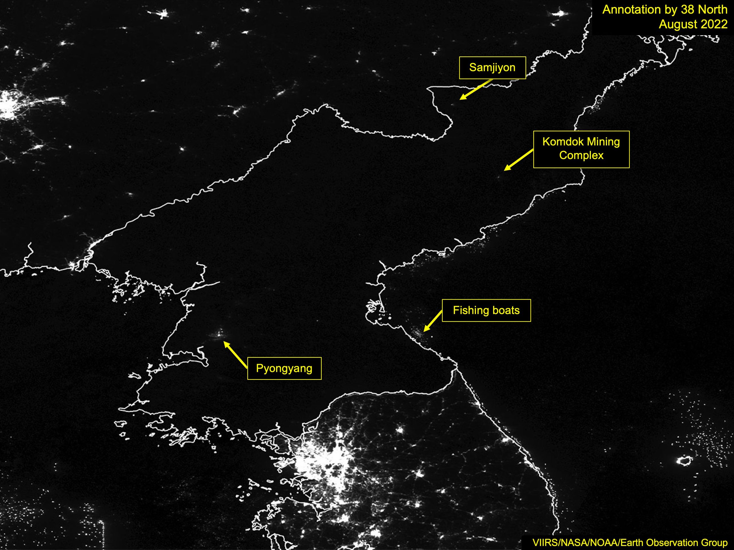
Samjiyon
The results of one of Kim Jong Un’s key projects, the multi-year redevelopment of Samjiyon, have presented one of the most dramatic changes in recent years. The lights of Samjiyon were barely visible until 2017, but its light signature began to grow as the redevelopment started. By 2019, the year reconstruction was completed, the city appeared much brighter at night.
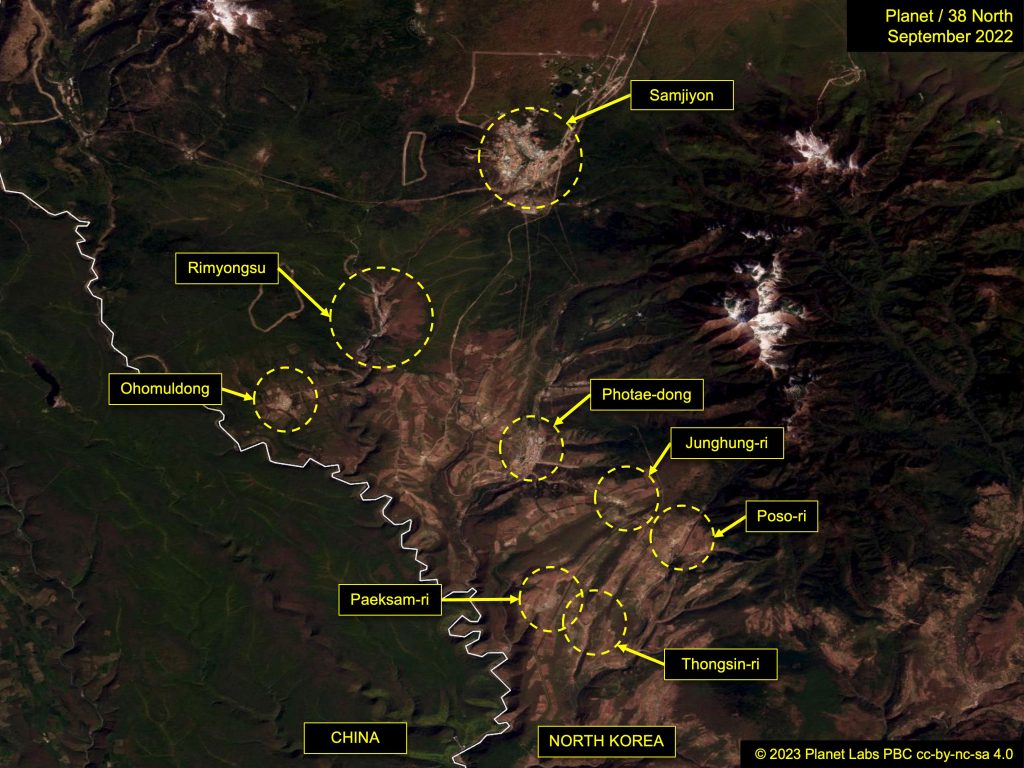
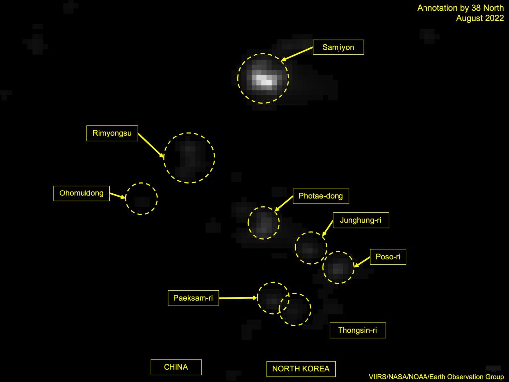
Figure 10a. Nightlights in the Samjiyon County area. Image © 2023 Planet Labs, PBC cc-by-nc-sa 4.0. For media licensing options, please contact [email protected]. Figure 10b. Nightlights in the Samjiyon County area. Photo: VIIRS/NASA/NOAA/Earth Observation Group. Annotation by 38 North.
That brightness has remained, and the subsequent redevelopment of Samjiyon’s satellite towns has also resulted in them becoming visible in nighttime imagery. Rimyongsu-dong, Phothae-dong, Junghung-ri, Poso-ri, Thongsin-ri, Paeksam-ri and Ohomuldong-dong are all visible in 2021 annual imagery where before, there was just darkness.
Wonsan
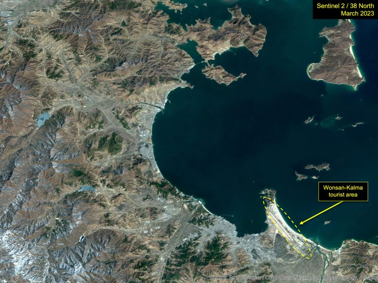
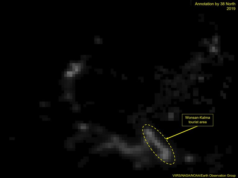
In Wonsan, the reconstruction of the airport and development of a prominent tourist area on the beach are both evident in nighttime imagery.
Until 2014, the peninsula on which the airport and beach resort sit was dark at night. Construction on the airport began in 2014 and was completed in 2015. That year, the site became visible on nighttime imagery.
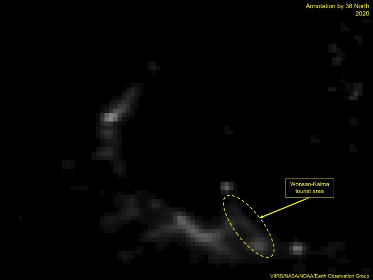
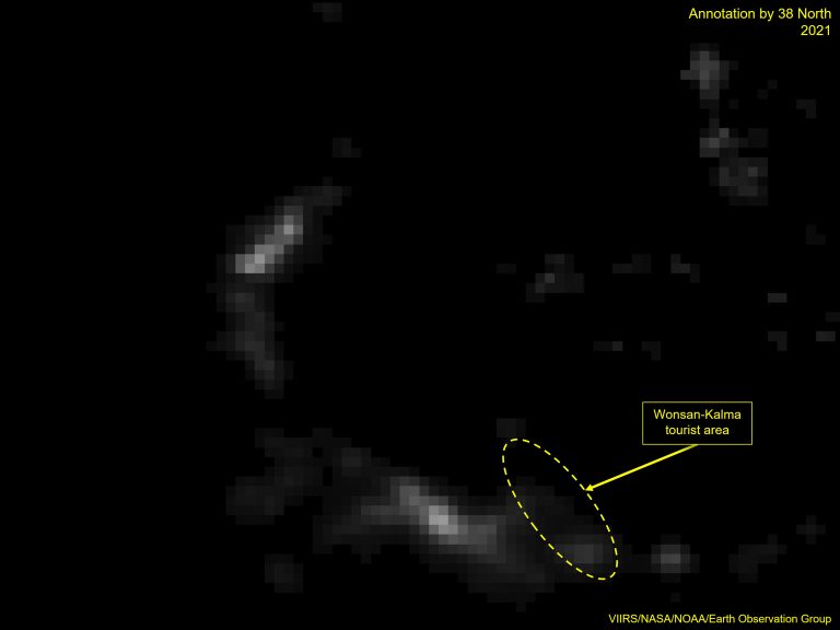
The peninsula fell dark after that until work on the beach resort began to pick up speed and intensity. Kim Jong Un visited the site in 2018 and called on workers to have it completed by April 2019. While that deadline was missed and pushed back a few times, the construction site can be seen bathed in light throughout 2019.
The onset of the COVID-19 pandemic and other priorities resulted in construction stalling, and the resort area has been largely dark since 2020.
Sunchon
Sunchon is a key base of North Korea’s chemical industry, and several of the largest factories are visible in 2021 annual imagery.
In May 2020, Kim Jong Un presided over the inauguration of the Sunchon Phosphatic Fertilizer Factory. Despite a slow start to fertilizer production, the factory is visible on nighttime imagery as one of the brightest spots in Sunchon from 2021.
A major new chemical factory under construction in Sunchon, referred to in state media as “the project for establishing C1 chemical industry,” is also visible from 2021, and the nearby Sunchon Cement Complex and Sunchon Thermal Power Plant also register.
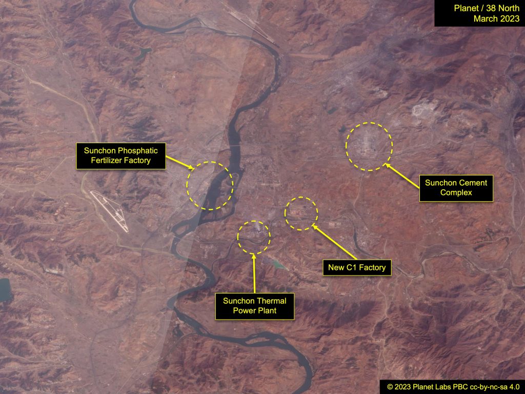
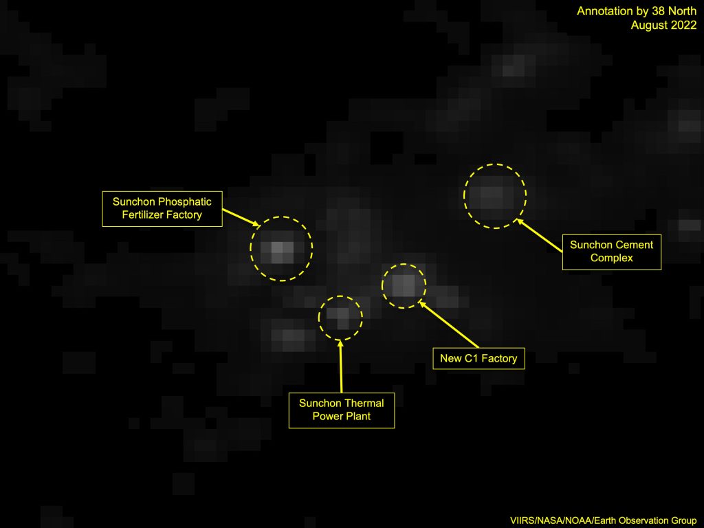
Figure 13a. Industrial nightlights in the Sunchon area. Image © 2023 Planet Labs, PBC cc-by-nc-sa 4.0. For media licensing options, please contact [email protected]. Figure 13b. Industrial nightlights in the Sunchon area. Photo: VIIRS/NASA/NOAA/Earth Observation Group. Annotation by 38 North.
North Korea vs. Myanmar
While North Korea has made some progress since the ISS image, it still lags far behind not only its neighbors, but other developing countries as well. Compared to Myanmar, for example, North Korea has much lower light emission at night.
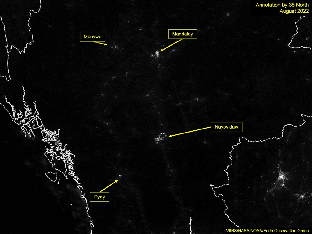
In Myanmar, several cities are easily visible at night, as is the main highway from Naypyidaw to Mandalay. The series of towns along the Irrawaddy River, which arcs west from Mandalay and then turns south to Pyay, can also be made out.
A look at North Korea, captured in the same month by the same satellite, reveals the obvious city lights of Pyongyang but little else. Few of the country’s main cities stand out, and the road network is not visible at all, probably due to the much lower volume of cars, movement restrictions on citizens and the lack of streetlights.